Newtown Trim night lights from space
Night Light of Newtown Trim (Leinster) from space (Ireland) Src. Average luminocity for 10x10km area is 5.6023% and for 50x50km: 5.6629%.
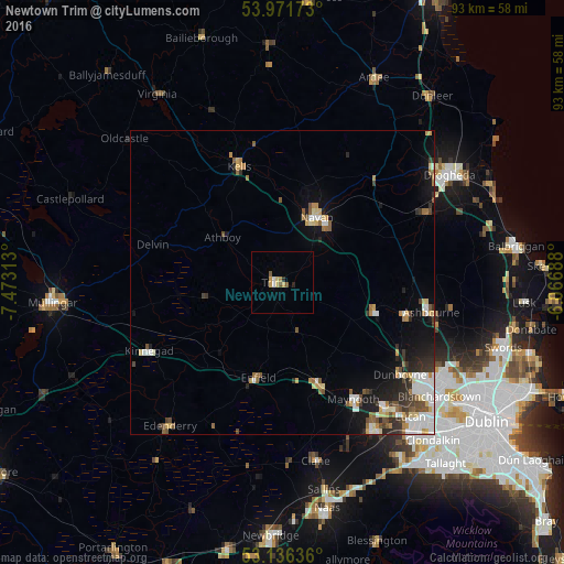
Analysis of Newtown Trim night lights 2016
Square area 10x10 km:
 0.51%
0.51%90-99
0.51%80-89
1.26%70-79
1.64%60-69
0.13%50-59
1.14%40-49
0.38%30-39
0%20-29
1.01%10-19
0%0-9
93.43%Square area 50x50 km:
0.98%90-99
0.97%80-89
0.68%70-79
0.63%60-69
0.61%50-59
0.84%40-49
0.72%30-39
0.64%20-29
1.22%10-19
2.68%0-9
90.03%Clear (daylight) street map image can be seen on geolist.org.
Map coordinates:
53° 58' 18.2" North, 7° 28' 23.3" West
53° 33' 22" North, 6° 46' 12" West
53° 8' 10.9" North, 6° 4' 0.8" West
Some cities around Newtown Trim sort by population:
• Navan
12.2 km =7.6 mi,  28°
28°
• Leixlip
27.9 km =17.3 mi,  139°
139°
• Maynooth
22.3 km =13.9 mi,  148°
148°
• Ashbourne
25.1 km =15.6 mi,  101°
101°
• Ratoath
21 km =13 mi, 104°
• Dunboyne
24.8 km =15.4 mi,  127°
127°
• Kilcock
18.3 km =11.4 mi,  159°
159°
• Confey
27 km =16.8 mi, 136°
2962222 (p: 6,781)
Sources (retrieved 2019-11-25):
» Earth at Night: Flat Maps 2012, 2016