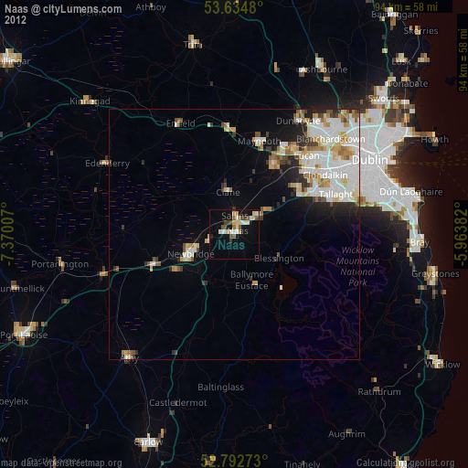
Naas night lights from space
Night Light of Naas (Leinster) from space (Ireland) Src. Average luminocity for 10x10km area is 26.798% and for 50x50km: 13.1362%.

Analysis of Naas night lights 2016
Square area 10x10 km:
 2.78%
2.78%90-99
5.68%80-89
2.4%70-79
4.42%60-69
4.67%50-59
2.78%40-49
2.9%30-39
2.02%20-29
0.51%10-19
35.23%0-9
36.62%Square area 50x50 km:
3.55%90-99
3.27%80-89
1.19%70-79
1.18%60-69
1.08%50-59
1.12%40-49
1.37%30-39
1.41%20-29
2.12%10-19
5.51%0-9
78.19%Clear (daylight) street map image can be seen on geolist.org.
Map coordinates:
53° 38' 5.3" North, 7° 22' 12.3" West
53° 12' 57" North, 6° 40' 1" West
52° 47' 33.8" North, 5° 57' 49.8" West
Some cities around Naas sort by population:
• Celbridge
16.2 km =10.1 mi,  30°
30°
• Droichead Nua
9.4 km =5.8 mi,  246°
246°
• Jobstown
18.6 km =11.6 mi,  67°
67°
• Kildare
17.8 km =11.1 mi, 248°
• Clane
8.5 km =5.3 mi,  350°
350°
• Eadestown
6.1 km =3.8 mi,  103°
103°
• Sallins
3.7 km =2.3 mi,  0°
0°
• Blessington
10.3 km =6.4 mi,  119°
119°
2962334 (p: 20,713)
Sources (retrieved 2019-11-25):
» Earth at Night: Flat Maps 2012, 2016