Kildare night lights from space
Night Light of Kildare (Leinster) from space (Ireland) Src. Average luminocity for 10x10km area is 6.7828% and for 50x50km: 4.1468%.
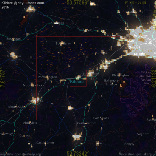
Analysis of Kildare night lights 2016
Square area 10x10 km:
 0.25%
0.25%90-99
0.25%80-89
1.01%70-79
1.14%60-69
1.77%50-59
0.63%40-49
1.52%30-39
0%20-29
2.02%10-19
1.01%0-9
90.4%Square area 50x50 km:
0.34%90-99
0.53%80-89
0.33%70-79
0.52%60-69
0.63%50-59
0.67%40-49
0.74%30-39
0.55%20-29
0.49%10-19
3.5%0-9
91.7%Clear (daylight) street map image can be seen on geolist.org.
Map coordinates:
53° 34' 32.4" North, 7° 37' 3.3" West
53° 9' 22" North, 6° 54' 52" West
52° 43' 56.7" North, 6° 12' 40.8" West
Some cities around Kildare sort by population:
• Naas
17.8 km =11.1 mi,  68°
68°
• Droichead Nua
8.4 km =5.2 mi, 69°
• Athy
18.8 km =11.7 mi,  193°
193°
• Portarlington
18.5 km =11.5 mi,  272°
272°
• Clane
21.2 km =13.2 mi,  44°
44°
• Cherryville
3.5 km =2.2 mi, 271°
• Eadestown
23 km =14.3 mi,  76°
76°
• Sallins
19.5 km =12.1 mi,  58°
58°
2963436 (p: 8,142)
Sources (retrieved 2019-11-25):
» Earth at Night: Flat Maps 2012, 2016