Droichead Nua night lights from space
Night Light of Droichead Nua (Leinster) from space (Ireland) Src. Average luminocity for 10x10km area is 17.2866% and for 50x50km: 6.6687%.
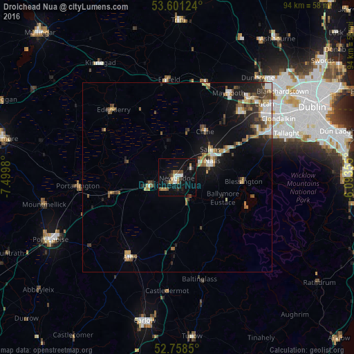
Analysis of Droichead Nua night lights 2016
Square area 10x10 km:
 2.15%
2.15%90-99
2.15%80-89
1.26%70-79
2.65%60-69
1.89%50-59
1.64%40-49
2.65%30-39
2.9%20-29
1.39%10-19
12.88%0-9
68.43%Square area 50x50 km:
0.81%90-99
1.03%80-89
0.7%70-79
0.77%60-69
0.85%50-59
1%40-49
1.14%30-39
1%20-29
1.36%10-19
4.67%0-9
86.66%Clear (daylight) street map image can be seen on geolist.org.
Map coordinates:
53° 36' 4.5" North, 7° 29' 59.3" West
53° 10' 55" North, 6° 47' 48" West
52° 45' 30.6" North, 6° 5' 36.8" West
Some cities around Droichead Nua sort by population:
• Naas
9.4 km =5.8 mi,  66°
66°
• Celbridge
24.4 km =15.2 mi,  43°
43°
• Kildare
8.4 km =5.2 mi,  249°
249°
• Clane
14.1 km =8.8 mi,  30°
30°
• Cherryville
11.7 km =7.3 mi,  256°
256°
• Eadestown
14.7 km =9.1 mi,  80°
80°
• Sallins
11.4 km =7.1 mi,  49°
49°
• Blessington
17.7 km =11 mi,  94°
94°
2962290 (p: 18,860)
Sources (retrieved 2019-11-25):
» Earth at Night: Flat Maps 2012, 2016