Wanaraja night lights from space
Night Light of Wanaraja (West Java) from space (Indonesia) Src. Average luminocity for 10x10km area is 6.0108% and for 50x50km: 8.4378%.
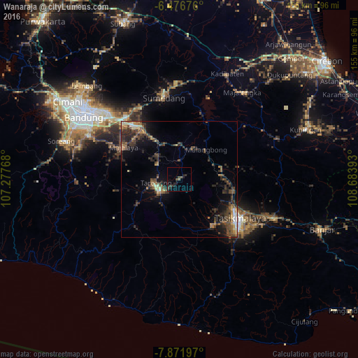
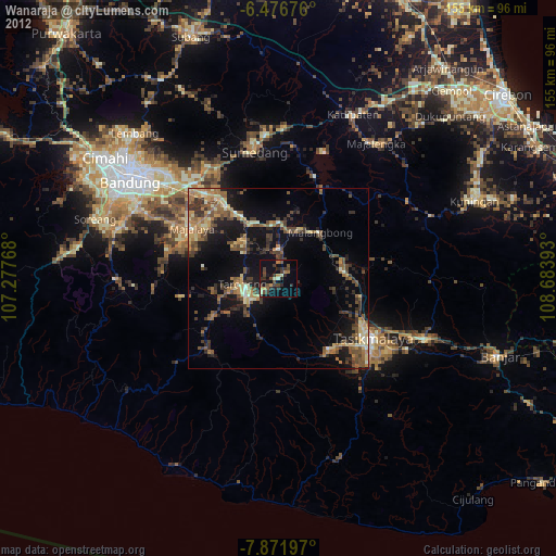
Analysis of Wanaraja night lights 2016
Square area 10x10 km:
 0%
0%90-99
0%80-89
0%70-79
0%60-69
0.22%50-59
1.52%40-49
3.03%30-39
2.16%20-29
4.11%10-19
2.6%0-9
86.36%Square area 50x50 km:
0.29%90-99
0.44%80-89
0.89%70-79
0.87%60-69
1.21%50-59
1.76%40-49
2.72%30-39
2.52%20-29
3.76%10-19
4.78%0-9
80.76%Clear (daylight) street map image can be seen on geolist.org.
Map coordinates:
6° 28' 36.3" South, 107° 16' 39.6" East
7° 10' 29.6" South, 107° 58' 50.9" East
7° 52' 19.1" South, 108° 41' 2.1" East
Some cities around Wanaraja sort by population:
• Tasikmalaya
31.4 km =19.5 mi,  122°
122°
• Sumedang
35.9 km =22.3 mi,  348°
348°
• Paseh
25.2 km =15.7 mi,  288°
288°
• Cileunyi
36.4 km =22.6 mi,  316°
316°
• Sumedang Utara
36.8 km =22.9 mi, 348°
• Kawalu
34 km =21.1 mi,  132°
132°
• Singaparna
24.3 km =15.1 mi,  143°
143°
• Rajapolah
23.6 km =14.7 mi,  102°
102°
1622138 (p: 26,240)
Sources (retrieved 2019-11-25):
» Earth at Night: Flat Maps 2012, 2016