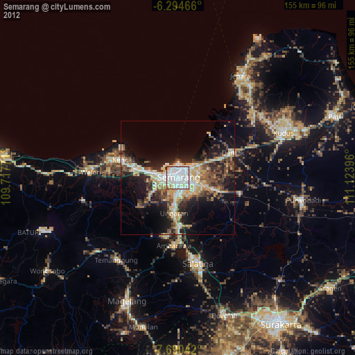
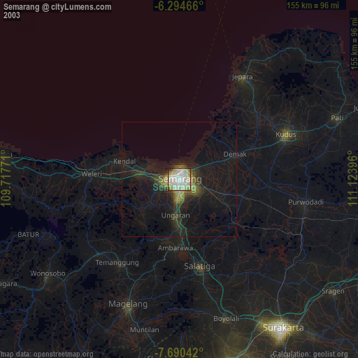
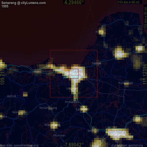
Semarang night lights from space
Night Light of Semarang (Central Java) from space (Indonesia) Src. Average luminocity for 10x10km area is 96.1883% and for 50x50km: 24.3389%.
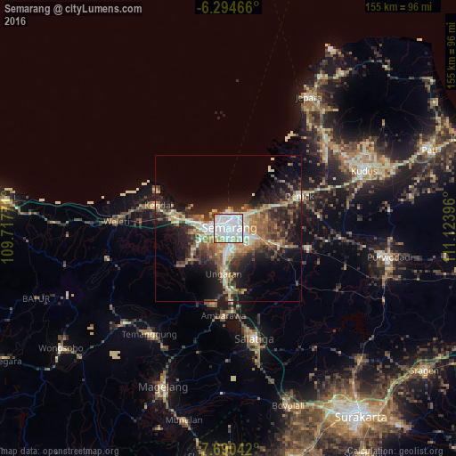
Analysis of Semarang night lights 2016
Square area 10x10 km:
 61.69%
90-99
25.54%80-89
4.11%70-79
6.49%60-69
0.65%50-59
1.08%40-49
0.22%30-39
0.22%20-29
0%10-19
0%0-9
0%Square area 50x50 km:
3.92%90-99
4.05%80-89
2.45%70-79
3.15%60-69
3.95%50-59
3.83%40-49
3.89%30-39
3.9%20-29
7.52%10-19
12.62%0-9
50.73%Clear (daylight) street map image can be seen on geolist.org.
Map coordinates:
6° 17' 40.8" South, 109° 43' 3.8" East
6° 59' 35" South, 110° 25' 15" East
7° 41' 25.5" South, 111° 7' 26.3" East
Some cities around Semarang sort by population:
• Salatiga
38.5 km =23.9 mi,  168°
168°
• Ungaran
16.4 km =10.2 mi,  186°
186°
• Ambarawa
30.2 km =18.8 mi,  184°
184°
• Pecangaan
45.8 km =28.5 mi,  44°
44°
• Weleri
39.2 km =24.4 mi,  273°
273°
• Mranggen
11.1 km =6.9 mi,  109°
109°
• Demak
26.7 km =16.6 mi,  64°
64°
• Welahan
39.1 km =24.3 mi, 56°
1627896 (p: 1,288,084)
Sources (retrieved 2019-11-25):
» NASA, Earths city lights 1995
» NASA city lights 2003
» Earth at Night: Flat Maps 2012, 2016