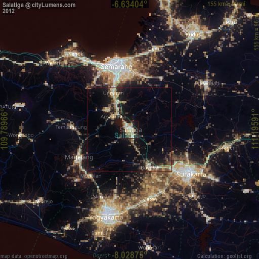
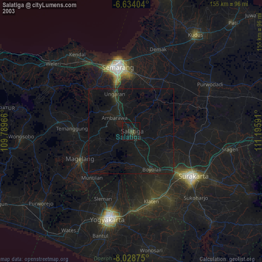
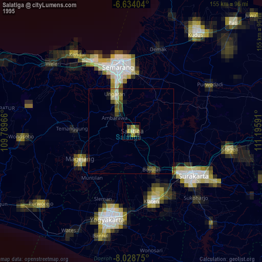
Salatiga night lights from space
Night Light of Salatiga (Central Java) from space (Indonesia) Src. Average luminocity for 10x10km area is 36.2251% and for 50x50km: 9.0938%.

Analysis of Salatiga night lights 2016
Square area 10x10 km:
 2.16%
2.16%90-99
4.33%80-89
2.6%70-79
8.01%60-69
8.23%50-59
10.17%40-49
5.63%30-39
3.9%20-29
5.19%10-19
39.39%0-9
10.39%Square area 50x50 km:
0.21%90-99
0.65%80-89
0.8%70-79
1.21%60-69
1.57%50-59
2.22%40-49
1.94%30-39
1.91%20-29
3.05%10-19
8.76%0-9
77.68%Clear (daylight) street map image can be seen on geolist.org.
Map coordinates:
6° 38' 2.5" South, 109° 47' 22.8" East
7° 19' 55" South, 110° 29' 34" East
8° 1' 43.5" South, 111° 11' 45.3" East
Some cities around Salatiga sort by population:
• Ungaran
23.5 km =14.6 mi,  335°
335°
• Magelang
34 km =21.1 mi,  243°
243°
• Ambarawa
13 km =8.1 mi,  305°
305°
• Boyolali
25.1 km =15.6 mi,  153°
153°
• Muntilan
35.4 km =22 mi,  218°
218°
• Mranggen
34 km =21.1 mi,  4°
4°
• Colomadu
36.1 km =22.4 mi,  128°
128°
• Ngemplak
34.6 km =21.5 mi, 134°
1629131 (p: 172,645)
Sources (retrieved 2019-11-25):
» NASA, Earths city lights 1995
» NASA city lights 2003
» Earth at Night: Flat Maps 2012, 2016