Jombang night lights from space
Night Light of Jombang (East Java) from space (Indonesia) Src. Average luminocity for 10x10km area is 69.1818% and for 50x50km: 24.8189%.
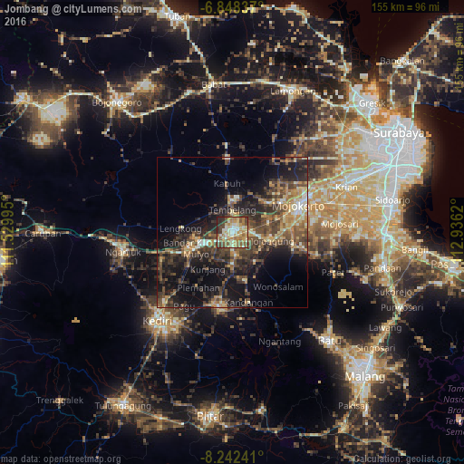
Analysis of Jombang night lights 2016
Square area 10x10 km:
 4.33%
4.33%90-99
19.48%80-89
13.64%70-79
15.37%60-69
15.58%50-59
9.52%40-49
10.61%30-39
6.28%20-29
5.19%10-19
0%0-9
0%Square area 50x50 km:
0.7%90-99
3.39%80-89
2.65%70-79
4.05%60-69
4%50-59
4.1%40-49
8%30-39
6.48%20-29
8.72%10-19
14.9%0-9
43.02%Clear (daylight) street map image can be seen on geolist.org.
Map coordinates:
6° 50' 54.1" South, 111° 31' 47.8" East
7° 32' 45.4" South, 112° 13' 59.1" East
8° 14' 32.7" South, 112° 56' 10.3" East
Some cities around Jombang sort by population:
• Mojokerto
23.8 km =14.8 mi,  68°
68°
• Kertosono
15.2 km =9.4 mi,  254°
254°
• Pare
25 km =15.5 mi,  188°
188°
• Gampengrejo
34.2 km =21.3 mi,  224°
224°
• Diwek
3.7 km =2.3 mi,  183°
183°
• Soko
22.5 km =14 mi, 71°
• Mojoagung
13.1 km =8.1 mi,  100°
100°
• Ngoro
15.6 km =9.7 mi,  169°
169°
1642414 (p: 126,465)
Sources (retrieved 2019-11-25):
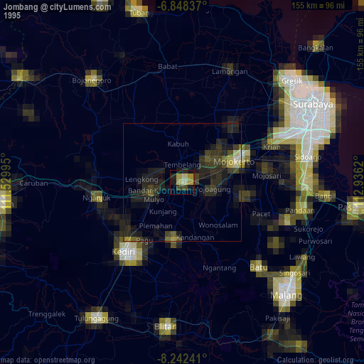
» NASA, Earths city lights 1995
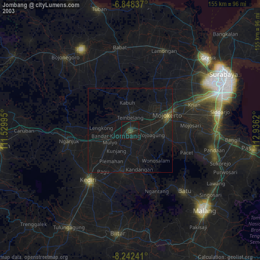
» NASA city lights 2003
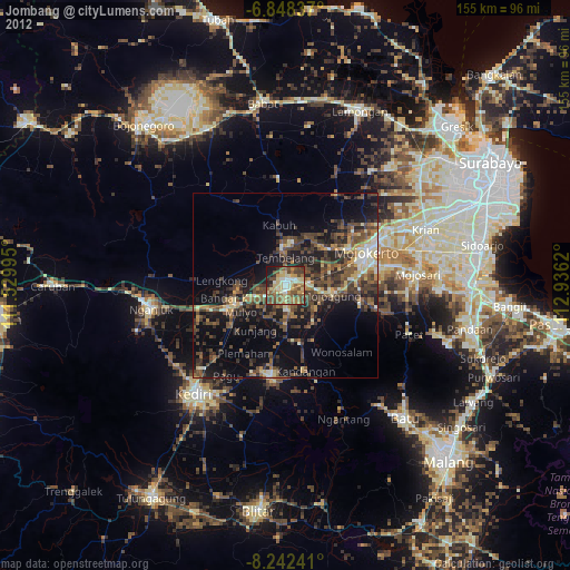
» Earth at Night: Flat Maps 2012, 2016