Mojokerto night lights from space
Night Light of Mojokerto (East Java) from space (Indonesia) Src. Average luminocity for 10x10km area is 82.026% and for 50x50km: 45.5277%.
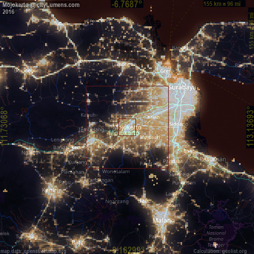
Analysis of Mojokerto night lights 2016
Square area 10x10 km:
 12.55%
90-99
26.41%80-89
12.12%70-79
31.82%60-69
12.77%50-59
2.81%40-49
1.52%30-39
0%20-29
0%10-19
0%0-9
0%Square area 50x50 km:
2.35%90-99
9.11%80-89
8.47%70-79
12.28%60-69
7.27%50-59
5.58%40-49
9.7%30-39
6.54%20-29
8.23%10-19
10.23%0-9
20.23%Clear (daylight) street map image can be seen on geolist.org.
Map coordinates:
6° 46' 7.3" South, 111° 43' 50.4" East
7° 27' 59" South, 112° 26' 1.7" East
8° 9' 46.8" South, 113° 8' 12.9" East
Some cities around Mojokerto sort by population:
• Jombang
23.8 km =14.8 mi,  248°
248°
• Tulangan Utara
23.9 km =14.9 mi,  91°
91°
• Diwek
25.6 km =15.9 mi,  240°
240°
• Krian
17.2 km =10.7 mi,  68°
68°
• Tanggulangin
29.6 km =18.4 mi,  97°
97°
• Driyorejo
23.6 km =14.7 mi,  61°
61°
• Soko
2 km =1.2 mi,  201°
201°
• Mojoagung
14.5 km =9 mi,  219°
219°
1635111 (p: 112,557)
Sources (retrieved 2019-11-25):
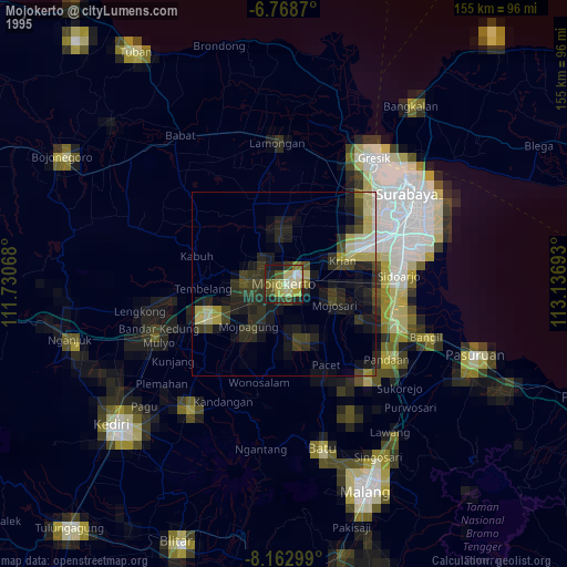
» NASA, Earths city lights 1995
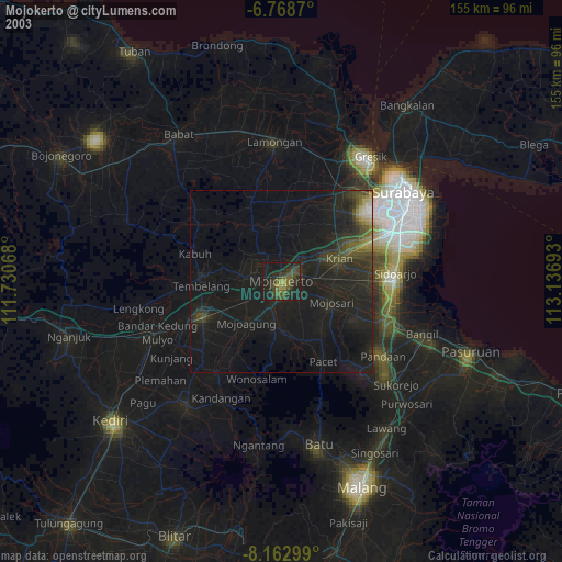
» NASA city lights 2003
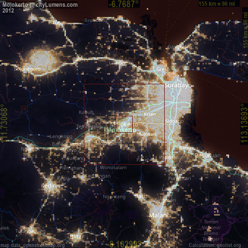
» Earth at Night: Flat Maps 2012, 2016