Ciamis night lights from space
Night Light of Ciamis (West Java) from space (Indonesia) Src. Average luminocity for 10x10km area is 20.2814% and for 50x50km: 7.8702%.
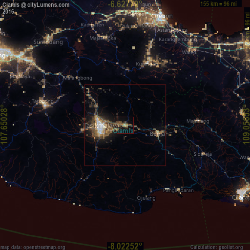
Analysis of Ciamis night lights 2016
Square area 10x10 km:
 0%
0%90-99
0%80-89
1.52%70-79
0.87%60-69
6.06%50-59
4.76%40-49
10.61%30-39
4.55%20-29
2.81%10-19
16.88%0-9
51.95%Square area 50x50 km:
0.51%90-99
0.57%80-89
0.66%70-79
0.75%60-69
1.14%50-59
1.94%40-49
2.85%30-39
1.69%20-29
2.49%10-19
5.21%0-9
82.2%Clear (daylight) street map image can be seen on geolist.org.
Map coordinates:
6° 37' 40" South, 107° 39' 1" East
7° 19' 32.5" South, 108° 21' 12.2" East
8° 1' 21.1" South, 109° 3' 23.5" East
Some cities around Ciamis sort by population:
• Tasikmalaya
14.6 km =9.1 mi,  269°
269°
• Kuningan
41.4 km =25.7 mi,  20°
20°
• Kawalu
17.2 km =10.7 mi,  248°
248°
• Singaparna
26.9 km =16.7 mi,  263°
263°
• Rajapolah
21.5 km =13.4 mi,  302°
302°
• Majenang
45.4 km =28.2 mi,  86°
86°
• Sidareja
51.5 km =32 mi,  110°
110°
• Wanaraja
44.4 km =27.6 mi,  292°
292°
1647149 (p: 123,637)
Sources (retrieved 2019-11-25):
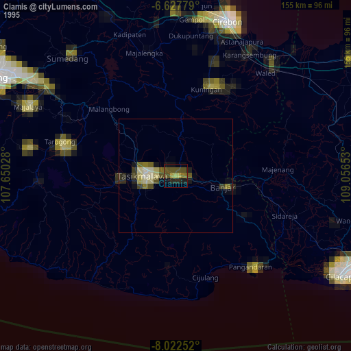
» NASA, Earths city lights 1995
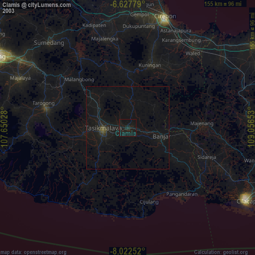
» NASA city lights 2003
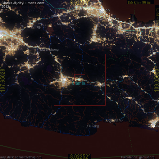
» Earth at Night: Flat Maps 2012, 2016