Bojonegoro night lights from space
Night Light of Bojonegoro (East Java) from space (Indonesia) Src. Average luminocity for 10x10km area is 57.4784% and for 50x50km: 17.3853%.
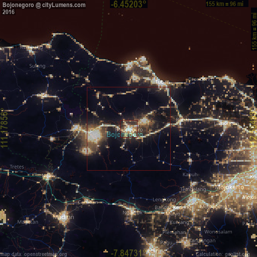
Analysis of Bojonegoro night lights 2016
Square area 10x10 km:
 3.68%
3.68%90-99
15.15%80-89
8.66%70-79
11.26%60-69
9.74%50-59
3.03%40-49
16.88%30-39
11.69%20-29
14.72%10-19
5.19%0-9
0%Square area 50x50 km:
0.91%90-99
3.27%80-89
2.06%70-79
1.82%60-69
1.88%50-59
1.42%40-49
4.79%30-39
4.8%20-29
5.73%10-19
12.66%0-9
60.67%Clear (daylight) street map image can be seen on geolist.org.
Map coordinates:
6° 27' 7.3" South, 111° 10' 42.9" East
7° 9' 0.7" South, 111° 52' 54.1" East
7° 50' 50.3" South, 112° 35' 5.4" East
Some cities around Bojonegoro sort by population:
• Jombang
58.6 km =36.4 mi,  138°
138°
• Tuban
34.6 km =21.5 mi,  35°
35°
• Nganjuk
50.6 km =31.4 mi,  177°
177°
• Kertosono
53.8 km =33.4 mi,  153°
153°
• Cepu
32.1 km =19.9 mi,  270°
270°
• Blora
54.9 km =34.1 mi,  291°
291°
• Babat
31.4 km =19.5 mi,  82°
82°
• Ngawi
55.7 km =34.6 mi,  239°
239°
1648451 (p: 86,568)
Sources (retrieved 2019-11-25):
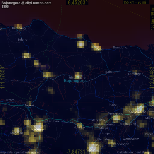
» NASA, Earths city lights 1995
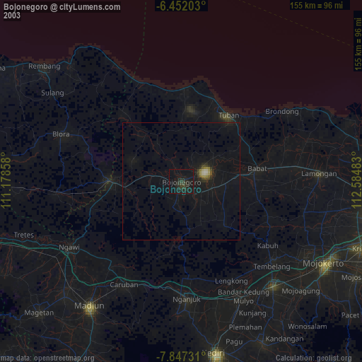
» NASA city lights 2003
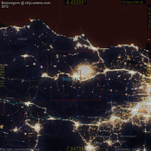
» Earth at Night: Flat Maps 2012, 2016