Zalaegerszeg night lights from space
Night Light of Zalaegerszeg (Zala) from space (Hungary) Src. Average luminocity for 10x10km area is 25.6607% and for 50x50km: 1.7442%.
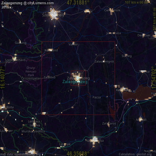
Analysis of Zalaegerszeg night lights 2016
Square area 10x10 km:
 2.83%
2.83%90-99
4.32%80-89
4.17%70-79
2.23%60-69
5.36%50-59
1.93%40-49
1.64%30-39
3.42%20-29
6.99%10-19
24.55%0-9
42.56%Square area 50x50 km:
0.16%90-99
0.27%80-89
0.23%70-79
0.21%60-69
0.27%50-59
0.12%40-49
0.27%30-39
0.28%20-29
0.49%10-19
1.08%0-9
96.62%Clear (daylight) street map image can be seen on geolist.org.
Map coordinates:
47° 19' 7.7" North, 16° 8' 26.8" East
46° 50' 24" North, 16° 50' 38" East
46° 21' 24.8" North, 17° 32' 49.3" East
Some cities around Zalaegerszeg sort by population:
• Keszthely
31.4 km =19.5 mi,  104°
104°
• Körmend
26.2 km =16.3 mi,  316°
316°
• Lenti
33.4 km =20.8 mi,  224°
224°
• Zalaszentgrót
21.3 km =13.2 mi,  56°
56°
• Sümeg
36.6 km =22.7 mi,  65°
65°
• Kobilje, SI
38.1 km =23.7 mi,  243°
243°
• Šalovci, SI
41.6 km =25.8 mi,  267°
267°
• Hodoš, SI
38.8 km =24.1 mi, 267°
3042638 (p: 61,898)
Sources (retrieved 2019-11-25):
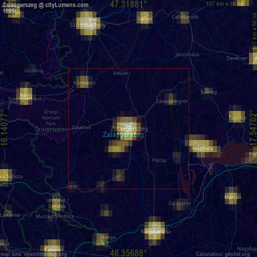
» NASA, Earths city lights 1995
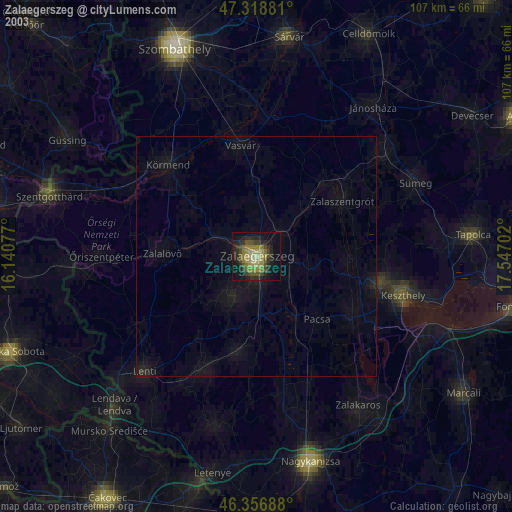
» NASA city lights 2003
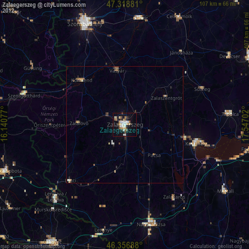
» Earth at Night: Flat Maps 2012, 2016