Kobilje night lights from space
Night Light of Kobilje from space (Slovenia) Src. Average luminocity for 10x10km area is 0% and for 50x50km: 1.6211%.
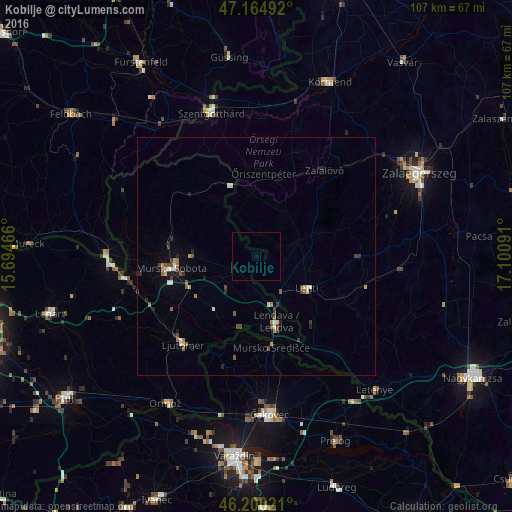
Analysis of Kobilje night lights 2016
Square area 10x10 km:
 0%
0%90-99
0%80-89
0%70-79
0%60-69
0%50-59
0%40-49
0%30-39
0%20-29
0%10-19
0%0-9
100%Square area 50x50 km:
0.09%90-99
0.29%80-89
0.14%70-79
0.09%60-69
0.26%50-59
0.32%40-49
0.37%30-39
0.3%20-29
0.3%10-19
0.29%0-9
97.54%Clear (daylight) street map image can be seen on geolist.org.
Map coordinates:
47° 9' 53.7" North, 15° 41' 40.8" East
46° 41' 5" North, 16° 23' 52" East
46° 12' 0.8" North, 17° 6' 3.3" East
Some cities around Kobilje sort by population:
• Lenti, HU
12.7 km =7.9 mi,  122°
122°
• Lendava
13.9 km =8.6 mi,  163°
163°
• Beltinci
14.9 km =9.3 mi,  233°
233°
• Odranci
14.1 km =8.8 mi,  219°
219°
• Turnišče
8.7 km =5.4 mi, 223°
• Dobrovnik
5.1 km =3.2 mi, 222°
• Velika Polana
13.1 km =8.1 mi,  197°
197°
• Moravske Toplice
13.5 km =8.4 mi,  269°
269°
3197959 (p: 618)
Sources (retrieved 2019-11-25):
» Earth at Night: Flat Maps 2012, 2016