Monor night lights from space
Night Light of Monor (Pest) from space (Hungary) Src. Average luminocity for 10x10km area is 5.6086% and for 50x50km: 12.4107%.
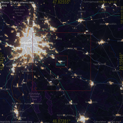
Analysis of Monor night lights 2016
Square area 10x10 km:
100  0.45%
0.45%
90-99 0.15%
80-89 1.49%
70-79 0.89%
60-69 0%
50-59 0%
40-49 2.38%
30-39 0.6%
20-29 0.6%
10-19 1.19%
0-9 92.26%
0.45%90-99
0.15%80-89
1.49%70-79
0.89%60-69
0%50-59
0%40-49
2.38%30-39
0.6%20-29
0.6%10-19
1.19%0-9
92.26%Square area 50x50 km:
100 3.74%
90-99 2.12%
80-89 0.85%
70-79 0.96%
60-69 1.16%
50-59 1.71%
40-49 1.98%
30-39 2.24%
20-29 2.48%
10-19 4.39%
0-9 78.37%
3.74%90-99
2.12%80-89
0.85%70-79
0.96%60-69
1.16%50-59
1.71%40-49
1.98%30-39
2.24%20-29
2.48%10-19
4.39%0-9
78.37%Clear (daylight) street map image can be seen on geolist.org.
Map coordinates:
47° 49' 32" North, 18° 44' 39.2" East
47° 21' 4.8" North, 19° 26' 50.4" East
46° 52' 22.1" North, 20° 9' 1.7" East
Some cities around Monor sort by population:
• Vecsés
13.6 km =8.5 mi,  297°
297°
• Gyömrő
9.1 km =5.7 mi,  337°
337°
• Pilis
10.3 km =6.4 mi,  132°
132°
• Üllő
8 km =5 mi, 300°
• Maglód
11.9 km =7.4 mi,  328°
328°
• Ócsa
17.3 km =10.7 mi,  250°
250°
• Sülysáp
12.9 km =8 mi,  30°
30°
• Tápiószecső
16.4 km =10.2 mi,  48°
48°
3047942 (p: 21,720)
Sources (retrieved 2019-11-25):
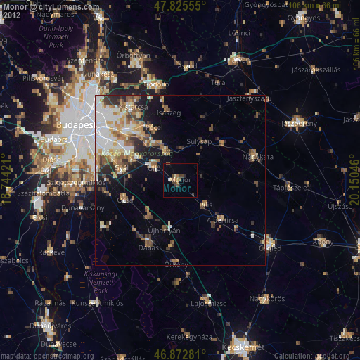
» Earth at Night: Flat Maps 2012, 2016