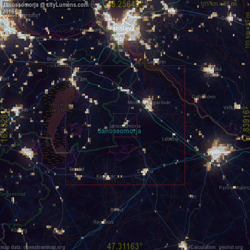
Jánossomorja night lights from space
Night Light of Jánossomorja (Győr-Moson-Sopron) from space (Hungary) Src. Average luminocity for 10x10km area is 4.1935% and for 50x50km: 3.9185%.
Analysis of Jánossomorja night lights 2016
Square area 10x10 km:
 0.3%
0.3%90-99
0.89%80-89
0.89%70-79
0.3%60-69
0.6%50-59
0.6%40-49
0.6%30-39
0.6%20-29
0.89%10-19
0.3%0-9
94.05%Square area 50x50 km:
0.3%90-99
0.73%80-89
0.56%70-79
0.41%60-69
0.46%50-59
0.58%40-49
0.49%30-39
0.46%20-29
0.44%10-19
1.78%0-9
93.79%Clear (daylight) street map image can be seen on geolist.org.
Map coordinates:
48° 15' 23.4" North, 16° 25' 58.5" East
47° 47' 10.4" North, 17° 8' 9.7" East
47° 18' 41.9" North, 17° 50' 21" East
Some cities around Jánossomorja sort by population:
• Győr
39 km =24.2 mi,  107°
107°
• Mosonmagyaróvár
13.5 km =8.4 mi,  47°
47°
• Šamorín, SK
30.1 km =18.7 mi,  25°
25°
• Csorna
21.2 km =13.2 mi,  156°
156°
• Kapuvár
23 km =14.3 mi,  200°
200°
• Neusiedl am See, AT
28.5 km =17.7 mi,  309°
309°
• Bruck an der Leitha, AT
37.6 km =23.4 mi, 312°
• Gabčíkovo, SK
35.1 km =21.8 mi,  70°
70°
3050927 (p: 5,985)
Sources (retrieved 2019-11-25):
» Earth at Night: Flat Maps 2012, 2016