Kapuvár night lights from space
Night Light of Kapuvár (Győr-Moson-Sopron) from space (Hungary) Src. Average luminocity for 10x10km area is 4.4176% and for 50x50km: 1.7067%.
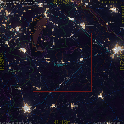
Analysis of Kapuvár night lights 2016
Square area 10x10 km:
 1.14%
1.14%90-99
0.57%80-89
0.28%70-79
0.43%60-69
0.43%50-59
0.28%40-49
0.85%30-39
0%20-29
1.99%10-19
0.28%0-9
93.75%Square area 50x50 km:
0.13%90-99
0.19%80-89
0.24%70-79
0.32%60-69
0.21%50-59
0.26%40-49
0.36%30-39
0.28%20-29
0.41%10-19
0.24%0-9
97.36%Clear (daylight) street map image can be seen on geolist.org.
Map coordinates:
48° 3' 51.4" North, 16° 19' 32.7" East
47° 35' 32.1" North, 17° 1' 43.9" East
47° 6' 57.2" North, 17° 43' 55.2" East
Some cities around Kapuvár sort by population:
• Sopron
34.4 km =21.4 mi,  287°
287°
• Mosonmagyaróvár
35.6 km =22.1 mi,  30°
30°
• Sárvár
38.3 km =23.8 mi,  190°
190°
• Kőszeg
43 km =26.7 mi,  238°
238°
• Celldömölk
38.4 km =23.9 mi,  166°
166°
• Csorna
16.7 km =10.4 mi,  82°
82°
• Neusiedl am See, AT
42.1 km =26.2 mi,  340°
340°
• Jánossomorja
23 km =14.3 mi,  20°
20°
3050594 (p: 10,661)
Sources (retrieved 2019-11-25):
» Earth at Night: Flat Maps 2012, 2016