Šamorín night lights from space
Night Light of Šamorín (Trnavský kraj) from space (Slovakia) Src. Average luminocity for 10x10km area is 11.6847% and for 50x50km: 14.0032%.
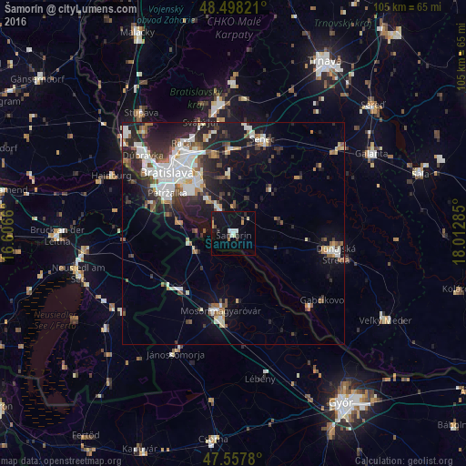
Analysis of Šamorín night lights 2016
Square area 10x10 km:
 1.56%
1.56%90-99
2.13%80-89
1.56%70-79
0.99%60-69
0.57%50-59
0%40-49
1.85%30-39
2.13%20-29
1.14%10-19
9.09%0-9
78.98%Square area 50x50 km:
3.14%90-99
3.01%80-89
0.85%70-79
0.88%60-69
1.44%50-59
1.59%40-49
1.42%30-39
2.32%20-29
4.6%10-19
8.74%0-9
72.01%Clear (daylight) street map image can be seen on geolist.org.
Map coordinates:
48° 29' 53.6" North, 16° 36' 23.8" East
48° 1' 48.5" North, 17° 18' 35" East
47° 33' 28.1" North, 18° 0' 46.3" East
Some cities around Šamorín sort by population:
• Bratislava
20 km =12.4 mi,  311°
311°
• Mosonmagyaróvár, HU
18.3 km =11.4 mi,  189°
189°
• Dunajská Streda
22.9 km =14.2 mi,  100°
100°
• Pezinok
29.1 km =18.1 mi,  353°
353°
• Senec
22.1 km =13.7 mi,  17°
17°
• Ivanka pri Dunaji
17.9 km =11.1 mi, 346°
• Bratislava - Vajnory
20.9 km =13 mi,  338°
338°
• Gabčíkovo
25.2 km =15.7 mi,  127°
127°
3057757 (p: 12,143)
Sources (retrieved 2019-11-25):
» Earth at Night: Flat Maps 2012, 2016