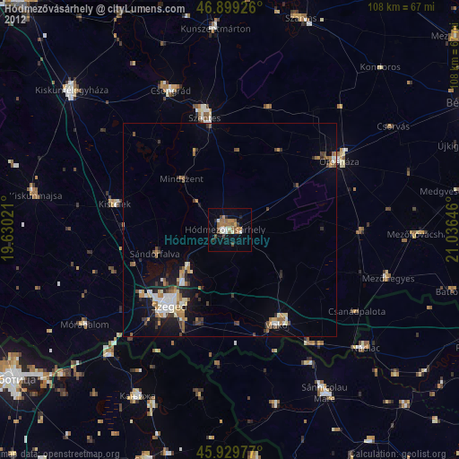
Hódmezővásárhely night lights from space
Night Light of Hódmezővásárhely (Csongrád) from space (Hungary) Src. Average luminocity for 10x10km area is 18.1786% and for 50x50km: 4.7459%.
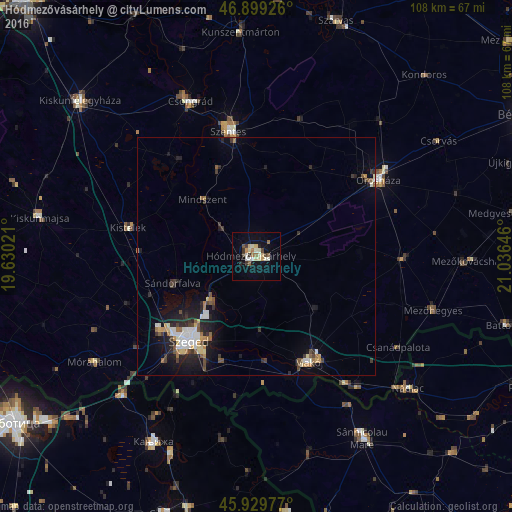
Analysis of Hódmezővásárhely night lights 2016
Square area 10x10 km:
 0.89%
0.89%90-99
4.91%80-89
3.72%70-79
0.89%60-69
2.38%50-59
1.49%40-49
1.93%30-39
2.38%20-29
1.49%10-19
11.16%0-9
68.75%Square area 50x50 km:
0.59%90-99
0.81%80-89
0.51%70-79
0.43%60-69
0.54%50-59
0.52%40-49
0.57%30-39
0.76%20-29
1.51%10-19
3.29%0-9
90.47%Clear (daylight) street map image can be seen on geolist.org.
Map coordinates:
46° 53' 57.3" North, 19° 37' 48.8" East
46° 25' 0" North, 20° 19' 60" East
45° 55' 47.2" North, 21° 2' 11.3" East
Some cities around Hódmezővásárhely sort by population:
• Szeged
23.1 km =14.4 mi,  217°
217°
• Orosháza
30.5 km =19 mi,  56°
56°
• Makó
25 km =15.5 mi,  152°
152°
• Sándorfalva
19 km =11.8 mi,  250°
250°
• Kistelek
27.8 km =17.3 mi,  282°
282°
• Mindszent
16.2 km =10.1 mi,  317°
317°
• Tótkomlós
30.7 km =19.1 mi,  90°
90°
• Algyő
13.2 km =8.2 mi,  226°
226°
719965 (p: 47,485)
Sources (retrieved 2019-11-25):
» Earth at Night: Flat Maps 2012, 2016