Szeged night lights from space
Night Light of Szeged (Csongrád) from space (Hungary) Src. Average luminocity for 10x10km area is 48.8051% and for 50x50km: 5.5029%.
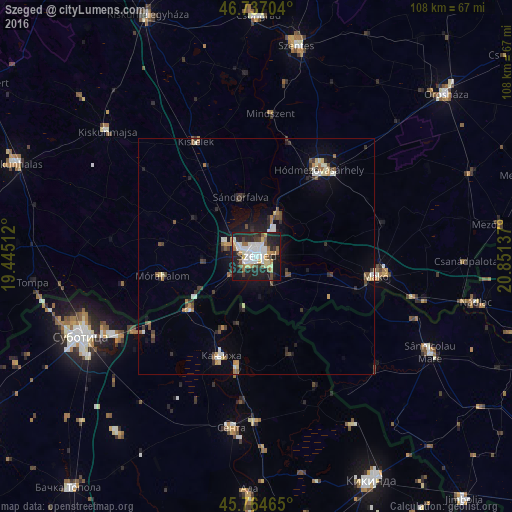
Analysis of Szeged night lights 2016
Square area 10x10 km:
 10.71%
90-99
11.46%80-89
6.99%70-79
3.72%60-69
5.65%50-59
4.61%40-49
4.32%30-39
4.02%20-29
20.68%10-19
26.19%0-9
1.64%Square area 50x50 km:
0.66%90-99
0.93%80-89
0.62%70-79
0.46%60-69
0.65%50-59
0.61%40-49
0.8%30-39
0.95%20-29
1.56%10-19
3.37%0-9
89.39%Clear (daylight) street map image can be seen on geolist.org.
Map coordinates:
46° 44' 13.3" North, 19° 26' 42.4" East
46° 15' 10.8" North, 20° 8' 53.7" East
45° 45' 52.7" North, 20° 51' 4.9" East
Some cities around Szeged sort by population:
• Hódmezővásárhely
23.1 km =14.4 mi,  37°
37°
• Makó
26.1 km =16.2 mi,  98°
98°
• Kanjiža, RS
22.1 km =13.7 mi,  200°
200°
• Novi Kneževac, RS
22.9 km =14.2 mi,  189°
189°
• Sándorfalva
12.6 km =7.8 mi,  342°
342°
• Kistelek
27.6 km =17.1 mi,  332°
332°
• Mórahalom
20.6 km =12.8 mi,  259°
259°
• Algyő
10.2 km =6.3 mi,  26°
26°
715429 (p: 164,883)
Sources (retrieved 2019-11-25):
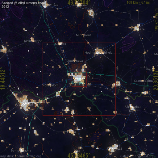
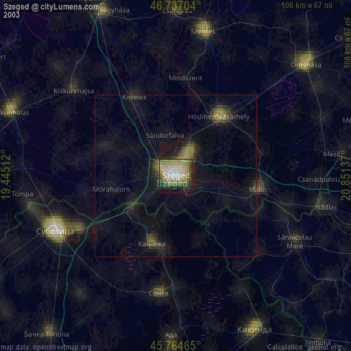
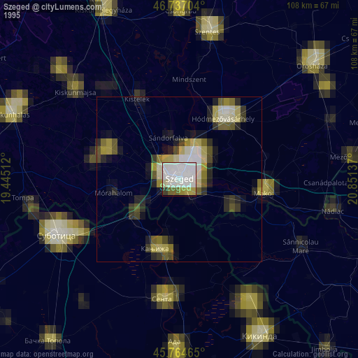
» NASA, Earths city lights 1995
» NASA city lights 2003
» Earth at Night: Flat Maps 2012, 2016