Fehérgyarmat night lights from space
Night Light of Fehérgyarmat (Szabolcs-Szatmár-Bereg) from space (Hungary) Src. Average luminocity for 10x10km area is 2.4858% and for 50x50km: 1.3743%.
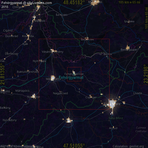
Analysis of Fehérgyarmat night lights 2016
Square area 10x10 km:
 0.43%
0.43%90-99
0.14%80-89
1.14%70-79
0%60-69
0%50-59
0%40-49
0.57%30-39
0.57%20-29
0.57%10-19
0.57%0-9
96.02%Square area 50x50 km:
0.17%90-99
0.22%80-89
0.21%70-79
0.1%60-69
0.17%50-59
0.07%40-49
0.2%30-39
0.17%20-29
0.37%10-19
0.87%0-9
97.46%Clear (daylight) street map image can be seen on geolist.org.
Map coordinates:
48° 27' 6.6" North, 21° 48' 48.8" East
47° 58' 60" North, 22° 31' 0" East
47° 30' 38" North, 23° 13' 11.3" East
Some cities around Fehérgyarmat sort by population:
• Satu Mare, RO
32.9 km =20.4 mi,  128°
128°
• Berehove, UA
26.5 km =16.5 mi,  20°
20°
• Mátészalka
14.7 km =9.1 mi,  257°
257°
• Nyírbátor
33.1 km =20.6 mi,  239°
239°
• Vásárosnamény
21.9 km =13.6 mi,  316°
316°
• Nagyecsed
16.1 km =10 mi,  215°
215°
• Lazuri, RO
30 km =18.6 mi,  119°
119°
• Csenger
20.5 km =12.7 mi,  143°
143°
720988 (p: 9,031)
Sources (retrieved 2019-11-25):
» Earth at Night: Flat Maps 2012, 2016