Csenger night lights from space
Night Light of Csenger (Szabolcs-Szatmár-Bereg) from space (Hungary) Src. Average luminocity for 10x10km area is 1.2024% and for 50x50km: 2.6612%.
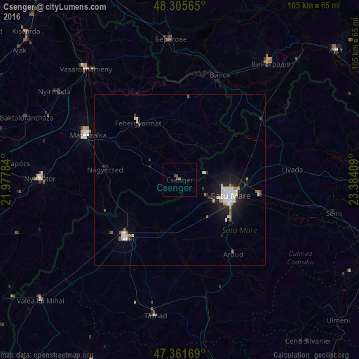
Analysis of Csenger night lights 2016
Square area 10x10 km:
 0%
0%90-99
0%80-89
0%70-79
0%60-69
0%50-59
0.6%40-49
1.64%30-39
0.15%20-29
0%10-19
0%0-9
97.62%Square area 50x50 km:
0.5%90-99
0.59%80-89
0.24%70-79
0.16%60-69
0.28%50-59
0.2%40-49
0.19%30-39
0.19%20-29
0.61%10-19
2.27%0-9
94.78%Clear (daylight) street map image can be seen on geolist.org.
Map coordinates:
48° 18' 20.3" North, 21° 58' 40.2" East
47° 50' 9" North, 22° 40' 51.5" East
47° 21' 42.1" North, 23° 23' 2.7" East
Some cities around Csenger sort by population:
• Satu Mare, RO
14.2 km =8.8 mi,  106°
106°
• Carei, RO
23.3 km =14.5 mi,  223°
223°
• Mátészalka
29.8 km =18.5 mi,  296°
296°
• Fehérgyarmat
20.5 km =12.7 mi,  323°
323°
• Halmeu, RO
28.9 km =18 mi,  59°
59°
• Nagyecsed
21.8 km =13.5 mi,  278°
278°
• Ardud, RO
27.1 km =16.8 mi,  146°
146°
• Lazuri, RO
13.9 km =8.6 mi,  83°
83°
721789 (p: 5,225)
Sources (retrieved 2019-11-25):
» Earth at Night: Flat Maps 2012, 2016