Edelény night lights from space
Night Light of Edelény (Borsod-Abaúj-Zemplén) from space (Hungary) Src. Average luminocity for 10x10km area is 2.4152% and for 50x50km: 2.8797%.
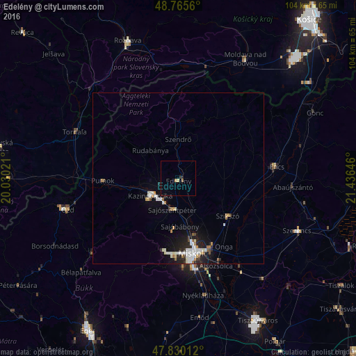
Analysis of Edelény night lights 2016
Square area 10x10 km:
 0%
0%90-99
0%80-89
0.6%70-79
0.6%60-69
0%50-59
0.6%40-49
0%30-39
0.6%20-29
0.6%10-19
0%0-9
97.02%Square area 50x50 km:
0.59%90-99
0.7%80-89
0.19%70-79
0.27%60-69
0.31%50-59
0.15%40-49
0.18%30-39
0.25%20-29
0.75%10-19
1.84%0-9
94.78%Clear (daylight) street map image can be seen on geolist.org.
Map coordinates:
48° 45' 56.2" North, 20° 1' 48.8" East
48° 18' 0" North, 20° 43' 60" East
47° 49' 48.4" North, 21° 26' 11.3" East
Some cities around Edelény sort by population:
• Miskolc
22.5 km =14 mi,  170°
170°
• Kazincbarcika
9.3 km =5.8 mi,  233°
233°
• Sajószentpéter
9.3 km =5.8 mi,  187°
187°
• Putnok
22.2 km =13.8 mi,  270°
270°
• Felsőzsolca
24.3 km =15.1 mi,  156°
156°
• Encs
29.8 km =18.5 mi,  82°
82°
• Alsózsolca
27.8 km =17.3 mi, 156°
• Szikszó
18.5 km =11.5 mi,  126°
126°
721246 (p: 11,037)
Sources (retrieved 2019-11-25):
» Earth at Night: Flat Maps 2012, 2016