Sajószentpéter night lights from space
Night Light of Sajószentpéter (Borsod-Abaúj-Zemplén) from space (Hungary) Src. Average luminocity for 10x10km area is 6.9598% and for 50x50km: 3.536%.
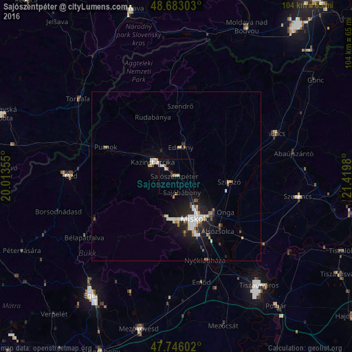
Analysis of Sajószentpéter night lights 2016
Square area 10x10 km:
 1.19%
1.19%90-99
1.49%80-89
0.3%70-79
0.89%60-69
1.04%50-59
0.45%40-49
0.15%30-39
0.45%20-29
1.04%10-19
0.74%0-9
92.26%Square area 50x50 km:
0.63%90-99
0.78%80-89
0.22%70-79
0.34%60-69
0.38%50-59
0.21%40-49
0.25%30-39
0.33%20-29
0.96%10-19
2.77%0-9
93.11%Clear (daylight) street map image can be seen on geolist.org.
Map coordinates:
48° 40' 58.9" North, 20° 0' 48.8" East
48° 13' 0" North, 20° 43' 0" East
47° 44' 45.7" North, 21° 25' 11.3" East
Some cities around Sajószentpéter sort by population:
• Miskolc
13.9 km =8.6 mi,  159°
159°
• Ózd
30.9 km =19.2 mi,  270°
270°
• Kazincbarcika
7.2 km =4.5 mi,  300°
300°
• Edelény
9.3 km =5.8 mi,  7°
7°
• Putnok
22.9 km =14.2 mi,  293°
293°
• Felsőzsolca
17.1 km =10.6 mi,  139°
139°
• Alsózsolca
20.4 km =12.7 mi, 143°
• Szikszó
16.2 km =10.1 mi,  96°
96°
715945 (p: 13,125)
Sources (retrieved 2019-11-25):
» Earth at Night: Flat Maps 2012, 2016