Miskolc night lights from space
Night Light of Miskolc (Borsod-Abaúj-Zemplén) from space (Hungary) Src. Average luminocity for 10x10km area is 45.7366% and for 50x50km: 4.5995%.
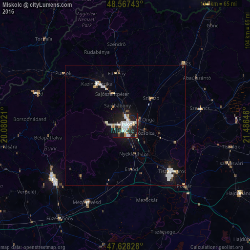

Analysis of Miskolc night lights 2016
Square area 10x10 km:
 12.35%
90-99
12.95%80-89
2.53%70-79
2.38%60-69
5.8%50-59
1.49%40-49
1.79%30-39
4.76%20-29
20.09%10-19
34.52%0-9
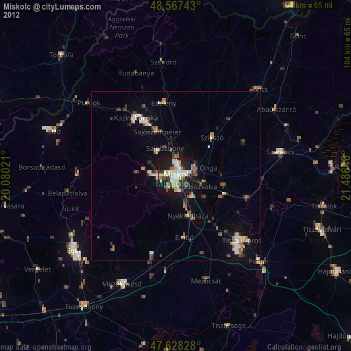
1.34%Square area 50x50 km:
0.92%90-99
0.98%80-89
0.26%70-79
0.42%60-69
0.48%50-59
0.27%40-49
0.28%30-39
0.52%20-29
1.1%10-19
3.8%0-9
90.97%Clear (daylight) street map image can be seen on geolist.org.
Map coordinates:
48° 34' 2.7" North, 20° 4' 48.8" East
48° 6' 0" North, 20° 46' 60" East
47° 37' 41.8" North, 21° 29' 11.3" East
Some cities around Miskolc sort by population:
• Kazincbarcika
20 km =12.4 mi,  326°
326°
• Sajószentpéter
13.9 km =8.6 mi,  339°
339°
• Edelény
22.5 km =14 mi,  350°
350°
• Felsőzsolca
6.2 km =3.9 mi,  90°
90°
• Alsózsolca
8 km =5 mi,  114°
114°
• Szikszó
15.7 km =9.8 mi,  45°
45°
• Tiszalúc
22.6 km =14 mi, 107°
• Emőd
18.7 km =11.6 mi,  172°
172°
717582 (p: 172,637)
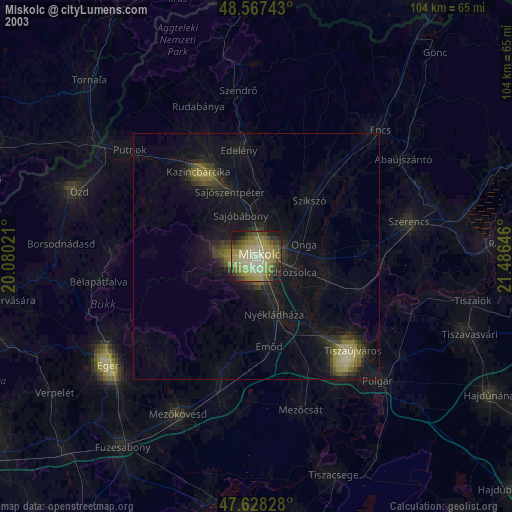
Sources (retrieved 2019-11-25):
» NASA, Earths city lights 1995
» NASA city lights 2003
» Earth at Night: Flat Maps 2012, 2016