Verrettes night lights from space
Night Light of Verrettes (Artibonite) from space (Haiti) Src. Average luminocity for 10x10km area is 0% and for 50x50km: 0.0001%.
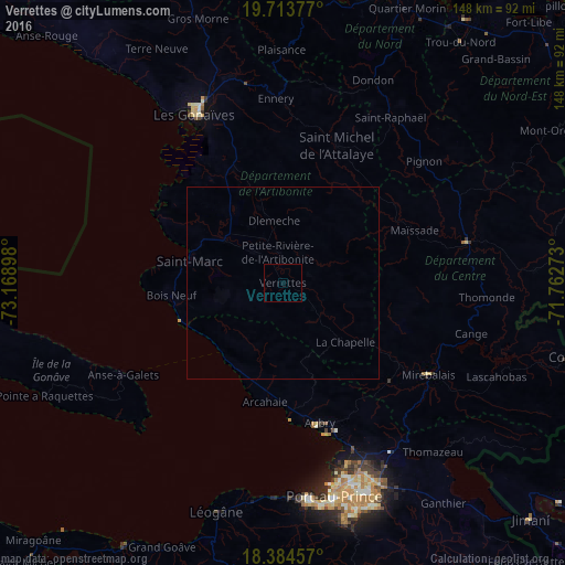
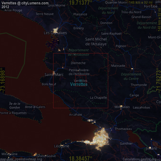
Analysis of Verrettes night lights 2016
Square area 10x10 km:
 0%
0%90-99
0%80-89
0%70-79
0%60-69
0%50-59
0%40-49
0%30-39
0%20-29
0%10-19
0%0-9
100%Square area 50x50 km:
0%90-99
0%80-89
0%70-79
0%60-69
0%50-59
0%40-49
0%30-39
0%20-29
0%10-19
0%0-9
100%Clear (daylight) street map image can be seen on geolist.org.
Map coordinates:
19° 42' 49.6" North, 73° 10' 8.3" West
19° 3' 1.8" North, 72° 27' 57.1" West
18° 23' 4.5" North, 71° 45' 45.8" West
Some cities around Verrettes sort by population:
• Saint-Marc
24.8 km =15.4 mi,  284°
284°
• Hinche
48.5 km =30.1 mi,  76°
76°
• Désarmes
10.1 km =6.3 mi,  128°
128°
• Dessalines
24.1 km =15 mi,  347°
347°
• Mirebalais
44.9 km =27.9 mi,  122°
122°
• Anse à Galets
48.5 km =30.1 mi,  240°
240°
• Pignon
48.5 km =30.1 mi,  49°
49°
• Mayisad
37 km =23 mi,  67°
67°
3716044 (p: 48,724)
Sources (retrieved 2019-11-25):
» Earth at Night: Flat Maps 2012, 2016