Saint-Marc night lights from space
Night Light of Saint-Marc (Artibonite) from space (Haiti) Src. Average luminocity for 10x10km area is 0% and for 50x50km: 0.0259%.
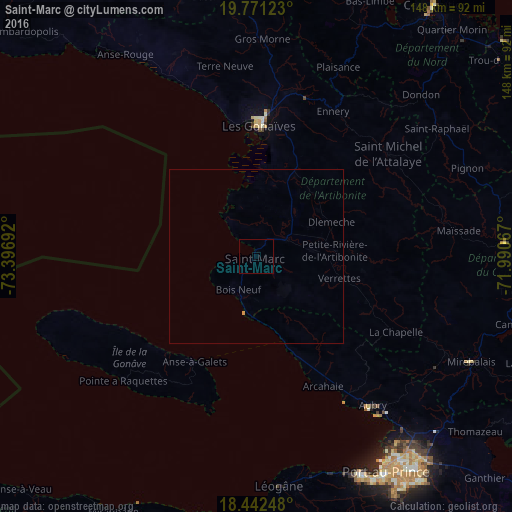
Analysis of Saint-Marc night lights 2016
Square area 10x10 km:
 0%
0%90-99
0%80-89
0%70-79
0%60-69
0%50-59
0%40-49
0%30-39
0%20-29
0%10-19
0%0-9
100%Square area 50x50 km:
0%90-99
0%80-89
0%70-79
0.03%60-69
0%50-59
0%40-49
0%30-39
0%20-29
0%10-19
0%0-9
99.97%Clear (daylight) street map image can be seen on geolist.org.
Map coordinates:
19° 46' 16.4" North, 73° 23' 48.9" West
19° 6' 29.5" North, 72° 41' 37.6" West
18° 26' 32.9" North, 71° 59' 26.4" West
Some cities around Saint-Marc sort by population:
• Gonaïves
37.7 km =23.4 mi,  0°
0°
• Verrettes
24.8 km =15.4 mi,  104°
104°
• Gressier
65.5 km =40.7 mi,  164°
164°
• Désarmes
34.3 km =21.3 mi,  111°
111°
• Dessalines
25.3 km =15.7 mi,  47°
47°
• Gros Morne
62.6 km =38.9 mi, 1°
• Anse à Galets
35.4 km =22 mi,  210°
210°
• Mayisad
58.7 km =36.5 mi,  82°
82°
3717588 (p: 66,226)
Sources (retrieved 2019-11-25):
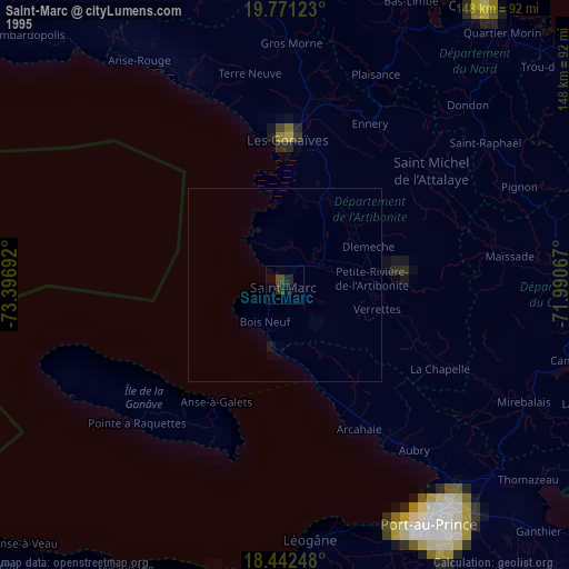
» NASA, Earths city lights 1995
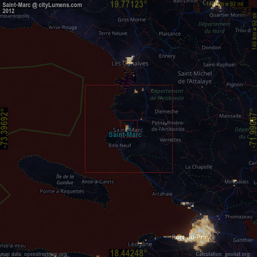
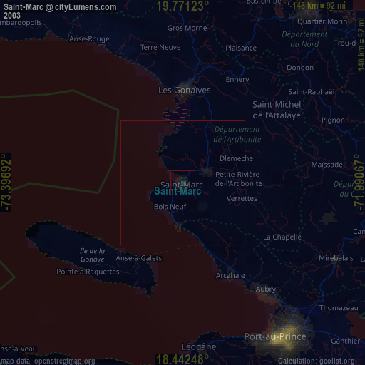
» NASA city lights 2003
» Earth at Night: Flat Maps 2012, 2016