Saint-Louis du Nord night lights from space
Night Light of Saint-Louis du Nord (Nord-Ouest) from space (Haiti) Src. Average luminocity for 10x10km area is 0% and for 50x50km: 0%.
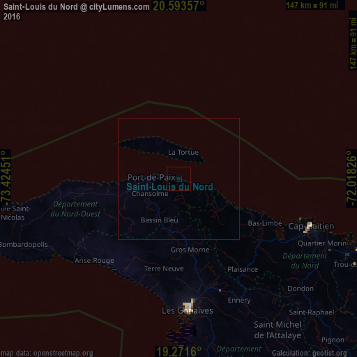
Analysis of Saint-Louis du Nord night lights 2016
Square area 10x10 km:
 0%
0%90-99
0%80-89
0%70-79
0%60-69
0%50-59
0%40-49
0%30-39
0%20-29
0%10-19
0%0-9
100%Square area 50x50 km:
0%90-99
0%80-89
0%70-79
0%60-69
0%50-59
0%40-49
0%30-39
0%20-29
0%10-19
0%0-9
100%Clear (daylight) street map image can be seen on geolist.org.
Map coordinates:
20° 35' 36.9" North, 73° 25' 28.2" West
19° 56' 2.3" North, 72° 43' 17" West
19° 16' 17.8" North, 72° 1' 5.7" West
Some cities around Saint-Louis du Nord sort by population:
• Port-de-Paix
11.4 km =7.1 mi,  273°
273°
• Okap
58.1 km =36.1 mi,  109°
109°
• Gonaïves
54.2 km =33.7 mi,  176°
176°
• Ti Port-de-Paix
11.7 km =7.3 mi, 269°
• Lenbe
41.8 km =26 mi,  127°
127°
• Gros Morne
29.6 km =18.4 mi,  171°
171°
• Milot
64.3 km =40 mi,  124°
124°
• Jean-Rabel
49.9 km =31 mi,  259°
259°
3717600 (p: 11,849)
Sources (retrieved 2019-11-25):
» Earth at Night: Flat Maps 2012, 2016