Županja night lights from space
Night Light of Županja (Vukovar-Sirmium) from space (Croatia) Src. Average luminocity for 10x10km area is 20.8424% and for 50x50km: 5.237%.
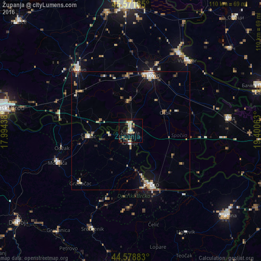
Analysis of Županja night lights 2016
Square area 10x10 km:
 1.06%
1.06%90-99
5.45%80-89
2.88%70-79
1.52%60-69
1.97%50-59
1.97%40-49
4.55%30-39
1.21%20-29
2.42%10-19
23.33%0-9
53.64%Square area 50x50 km:
0.53%90-99
0.91%80-89
0.52%70-79
0.74%60-69
0.65%50-59
0.71%40-49
0.7%30-39
0.57%20-29
0.68%10-19
3.35%0-9
90.63%Clear (daylight) street map image can be seen on geolist.org.
Map coordinates:
45° 34' 18.7" North, 17° 59' 39.8" East
45° 4' 39" North, 18° 41' 51" East
44° 34' 43.8" North, 19° 24' 2.3" East
Some cities around Županja sort by population:
• Brčko, BA
24.7 km =15.3 mi,  159°
159°
• Vinkovci
24.9 km =15.5 mi,  19°
19°
• Odžak, BA
30.1 km =18.7 mi,  258°
258°
• Mionica, BA
29.7 km =18.5 mi,  217°
217°
• Ivankovo
23.5 km =14.6 mi,  357°
357°
• Otok
16.5 km =10.3 mi,  62°
62°
• Donja Mahala, BA
4.4 km =2.7 mi,  209°
209°
• Gunja
25.1 km =15.6 mi,  150°
150°
3186294 (p: 13,842)
Sources (retrieved 2019-11-25):
» Earth at Night: Flat Maps 2012, 2016