Sisak night lights from space
Night Light of Sisak (Sisačko-Moslavačka) from space (Croatia) Src. Average luminocity for 10x10km area is 40.3032% and for 50x50km: 3.6399%.
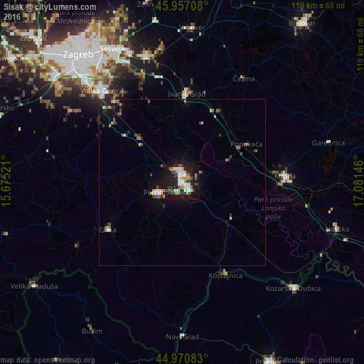
Analysis of Sisak night lights 2016
Square area 10x10 km:
 8.1%
8.1%90-99
8.73%80-89
2.86%70-79
5.24%60-69
5.08%50-59
3.17%40-49
4.76%30-39
4.92%20-29
12.86%10-19
37.62%0-9
6.67%Square area 50x50 km:
0.46%90-99
0.49%80-89
0.3%70-79
0.39%60-69
0.46%50-59
0.53%40-49
0.52%30-39
0.48%20-29
1.05%10-19
3.15%0-9
92.18%Clear (daylight) street map image can be seen on geolist.org.
Map coordinates:
45° 57' 25.5" North, 15° 40' 30.8" East
45° 27' 58" North, 16° 22' 42" East
44° 58' 15" North, 17° 4' 53.3" East
Some cities around Sisak sort by population:
• Sesvete
45.4 km =28.2 mi,  333°
333°
• Velika Gorica
36.1 km =22.4 mi,  319°
319°
• Kutina
31.5 km =19.6 mi,  88°
88°
• Petrinja
7.6 km =4.7 mi,  245°
245°
• Popovača
22.4 km =13.9 mi,  59°
59°
• Brezovica
46.7 km =29 mi,  308°
308°
• Kozarska Dubica, BA
46.6 km =29 mi,  133°
133°
• Novi Grad, BA
46.7 km =29 mi,  180°
180°
3190813 (p: 35,748)
Sources (retrieved 2019-11-25):
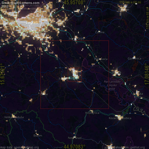
» Earth at Night: Flat Maps 2012, 2016