Novi Grad night lights from space
Night Light of Novi Grad (Srpska) from space (Bosnia and Herzegovina) Src. Average luminocity for 10x10km area is 2.1394% and for 50x50km: 0.2911%.
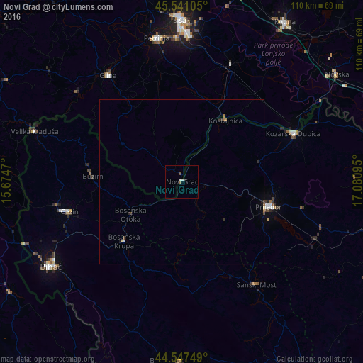
Analysis of Novi Grad night lights 2016
Square area 10x10 km:
 0%
0%90-99
1.21%80-89
0%70-79
0%60-69
0.15%50-59
1.06%40-49
0%30-39
0%20-29
0%10-19
0.61%0-9
96.97%Square area 50x50 km:
0%90-99
0.07%80-89
0.02%70-79
0.02%60-69
0.06%50-59
0.04%40-49
0.05%30-39
0.04%20-29
0.1%10-19
0.08%0-9
99.51%Clear (daylight) street map image can be seen on geolist.org.
Map coordinates:
45° 32' 27.8" North, 15° 40' 28.9" East
45° 2' 47.1" North, 16° 22' 40.2" East
44° 32' 51" North, 17° 4' 51.4" East
Some cities around Novi Grad sort by population:
• Prijedor
27.4 km =17 mi,  105°
105°
• Cazin
35.3 km =21.9 mi,  255°
255°
• Bosanska Krupa
25.5 km =15.8 mi,  224°
224°
• Stijena
30.5 km =19 mi,  246°
246°
• Todorovo
35.4 km =22 mi,  277°
277°
• Bužim
27.1 km =16.8 mi,  271°
271°
• Otoka
18.3 km =11.4 mi,  238°
238°
• Varoška Rijeka
28.6 km =17.8 mi, 279°
3203647 (p: 8,920)
Sources (retrieved 2019-11-25):
» Earth at Night: Flat Maps 2012, 2016