Novi Vinodolski night lights from space
Night Light of Novi Vinodolski (Primorsko-Goranska) from space (Croatia) Src. Average luminocity for 10x10km area is 9.0061% and for 50x50km: 4.7974%.
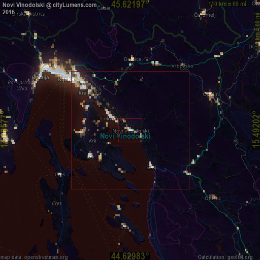
Analysis of Novi Vinodolski night lights 2016
Square area 10x10 km:
 0.61%
0.61%90-99
1.21%80-89
0.61%70-79
1.06%60-69
1.36%50-59
3.03%40-49
1.97%30-39
0.45%20-29
1.21%10-19
0.45%0-9
88.03%Square area 50x50 km:
0.55%90-99
0.84%80-89
0.56%70-79
0.4%60-69
0.49%50-59
0.67%40-49
0.85%30-39
0.57%20-29
1.11%10-19
2.33%0-9
91.64%Clear (daylight) street map image can be seen on geolist.org.
Map coordinates:
45° 37' 19.1" North, 14° 5' 8.8" East
45° 7' 41" North, 14° 47' 20" East
44° 37' 47.4" North, 15° 29' 31.3" East
Some cities around Novi Vinodolski sort by population:
• Rijeka
35 km =21.7 mi,  309°
309°
• Ogulin
37.7 km =23.4 mi,  65°
65°
• Opatija
44.5 km =27.7 mi,  301°
301°
• Drenova
37.4 km =23.2 mi, 311°
• Crikvenica
9.3 km =5.8 mi, 305°
• Senj
17.9 km =11.1 mi,  149°
149°
• Osilnica, SI
45.2 km =28.1 mi,  350°
350°
• Kostel, SI
43.3 km =26.9 mi,  12°
12°
3194355 (p: 5,282)
Sources (retrieved 2019-11-25):
» Earth at Night: Flat Maps 2012, 2016