Villa de San Antonio night lights from space
Night Light of Villa de San Antonio (Comayagua) from space (Honduras) Src. Average luminocity for 10x10km area is 14.0714% and for 50x50km: 3.7354%.
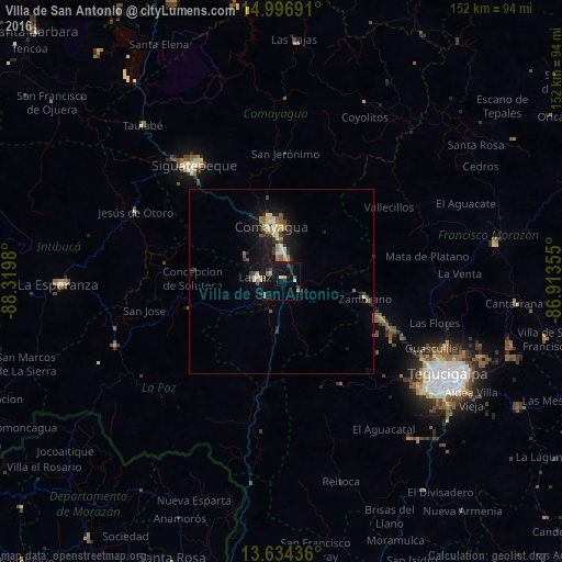
Analysis of Villa de San Antonio night lights 2016
Square area 10x10 km:
 0%
0%90-99
2.16%80-89
2.38%70-79
1.52%60-69
0%50-59
1.73%40-49
1.95%30-39
3.68%20-29
4.11%10-19
17.32%0-9
65.15%Square area 50x50 km:
0.16%90-99
0.46%80-89
0.57%70-79
0.48%60-69
0.36%50-59
0.54%40-49
0.53%30-39
0.79%20-29
0.88%10-19
3.6%0-9
91.63%Clear (daylight) street map image can be seen on geolist.org.
Map coordinates:
14° 59' 48.9" North, 88° 19' 11.3" West
14° 19' 0" North, 87° 37' 0" West
13° 38' 3.7" North, 86° 54' 48.8" West
Some cities around Villa de San Antonio sort by population:
• Tegucigalpa
51.3 km =31.9 mi,  120°
120°
• Comayagua
15.1 km =9.4 mi,  351°
351°
• Siguatepeque
39.2 km =24.4 mi,  323°
323°
• La Paz
6.7 km =4.2 mi,  272°
272°
• Talanga
58.2 km =36.2 mi,  80°
80°
• Marcala
48.6 km =30.2 mi,  247°
247°
• Jesús de Otoro
43.6 km =27.1 mi,  295°
295°
• Ajuterique
11.6 km =7.2 mi,  309°
309°
3600340 (p: 5,390)
Sources (retrieved 2019-11-25):
» Earth at Night: Flat Maps 2012, 2016