Siguatepeque night lights from space
Night Light of Siguatepeque (Comayagua) from space (Honduras) Src. Average luminocity for 10x10km area is 31.4156% and for 50x50km: 3.8384%.
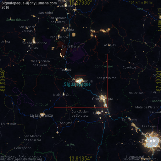
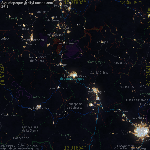
Analysis of Siguatepeque night lights 2016
Square area 10x10 km:
 3.68%
3.68%90-99
5.84%80-89
4.11%70-79
3.9%60-69
4.11%50-59
5.41%40-49
5.84%30-39
4.11%20-29
1.52%10-19
29.65%0-9
31.82%Square area 50x50 km:
0.25%90-99
0.65%80-89
0.66%70-79
0.47%60-69
0.43%50-59
0.61%40-49
0.57%30-39
0.62%20-29
0.62%10-19
3.13%0-9
92%Clear (daylight) street map image can be seen on geolist.org.
Map coordinates:
15° 16' 45.7" North, 88° 32' 11.3" West
14° 36' 0" North, 87° 49' 60" West
13° 55' 6.7" North, 87° 7' 48.8" West
Some cities around Siguatepeque sort by population:
• Comayagua
26.8 km =16.7 mi,  128°
128°
• La Paz
35.3 km =21.9 mi,  151°
151°
• Intibucá
47.8 km =29.7 mi,  228°
228°
• Santa Cruz de Yojoa
43.2 km =26.8 mi,  350°
350°
• Las Vegas, Santa Barbara
40.2 km =25 mi,  319°
319°
• Jesús de Otoro
20.7 km =12.9 mi, 231°
• Villa de San Antonio
39.2 km =24.4 mi,  143°
143°
• Ajuterique
28 km =17.4 mi, 149°
3601311 (p: 43,141)
Sources (retrieved 2019-11-25):
» Earth at Night: Flat Maps 2012, 2016