La Entrada night lights from space
Night Light of La Entrada (Copán) from space (Honduras) Src. Average luminocity for 10x10km area is 12.405% and for 50x50km: 1.0985%.
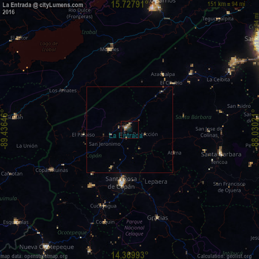
Analysis of La Entrada night lights 2016
Square area 10x10 km:
 0%
0%90-99
1.03%80-89
3.1%70-79
0.41%60-69
3.1%50-59
2.27%40-49
2.69%30-39
3.1%20-29
2.48%10-19
0.83%0-9
80.99%Square area 50x50 km:
0%90-99
0.07%80-89
0.2%70-79
0.12%60-69
0.19%50-59
0.15%40-49
0.2%30-39
0.44%20-29
0.31%10-19
0.24%0-9
98.09%Clear (daylight) street map image can be seen on geolist.org.
Map coordinates:
15° 43' 40.5" North, 89° 26' 11.3" West
15° 3' 0" North, 88° 43' 60" West
14° 22' 11.7" North, 88° 1' 48.8" West
Some cities around La Entrada sort by population:
• Santa Rosa de Copán
31.9 km =19.8 mi,  188°
188°
• Morales, GT
48.3 km =30 mi,  346°
346°
• Santa Bárbara
55.3 km =34.4 mi,  105°
105°
• Gracias
53.6 km =33.3 mi,  162°
162°
• Copán
50.8 km =31.6 mi,  241°
241°
• Azacualpa
38 km =23.6 mi,  30°
30°
• San Luis
37.8 km =23.5 mi,  84°
84°
• Florida
10.9 km =6.8 mi,  260°
260°
3607986 (p: 14,705)
Sources (retrieved 2019-11-25):
» Earth at Night: Flat Maps 2012, 2016