Ciudad Choluteca night lights from space
Night Light of Ciudad Choluteca (Choluteca) from space (Honduras) Src. Average luminocity for 10x10km area is 38.064% and for 50x50km: 2.5523%.
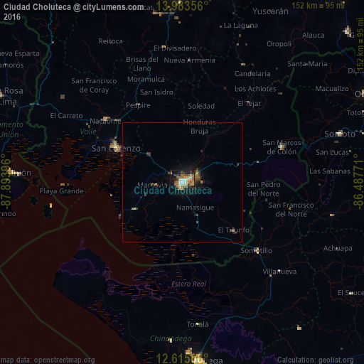
Analysis of Ciudad Choluteca night lights 2016
Square area 10x10 km:
 3.51%
3.51%90-99
5.79%80-89
6.82%70-79
4.96%60-69
8.06%50-59
7.23%40-49
3.72%30-39
5.99%20-29
5.79%10-19
34.3%0-9
13.84%Square area 50x50 km:
0.14%90-99
0.23%80-89
0.34%70-79
0.22%60-69
0.48%50-59
0.45%40-49
0.55%30-39
0.52%20-29
0.57%10-19
2.27%0-9
94.23%Clear (daylight) street map image can be seen on geolist.org.
Map coordinates:
13° 59' 0.8" North, 87° 53' 38.3" West
13° 18' 1" North, 87° 11' 27" West
12° 36' 54.2" North, 86° 29' 15.8" West
Some cities around Ciudad Choluteca sort by population:
• San Lorenzo
31 km =19.3 mi,  296°
296°
• Somotillo, NI
42.1 km =26.2 mi,  132°
132°
• Nacaome
41.4 km =25.7 mi,  309°
309°
• San Marcos de Colón
44.8 km =27.8 mi,  70°
70°
• Puerto Morazán, NI
50.1 km =31.1 mi,  177°
177°
• El Triunfo
29 km =18 mi, 134°
• La Alianza
62.3 km =38.7 mi,  292°
292°
• Monjarás
22.7 km =14.1 mi,  240°
240°
3613528 (p: 75,872)
Sources (retrieved 2019-11-25):
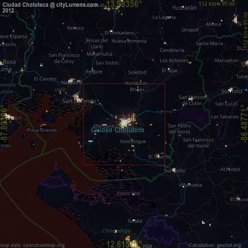
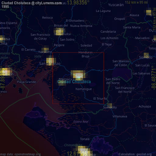
» NASA, Earths city lights 1995
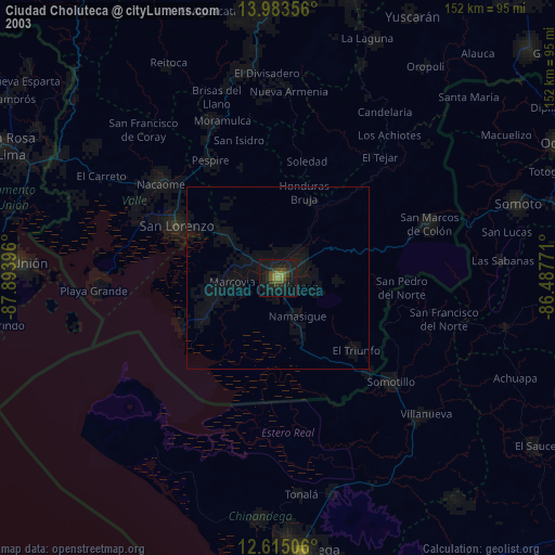
» NASA city lights 2003
» Earth at Night: Flat Maps 2012, 2016