Hong Kong night lights from space
Night Light of Hong Kong (Central and Western) from space (Hong Kong) Src. Average luminocity for 10x10km area is 88.5076% and for 50x50km: 32.0804%.
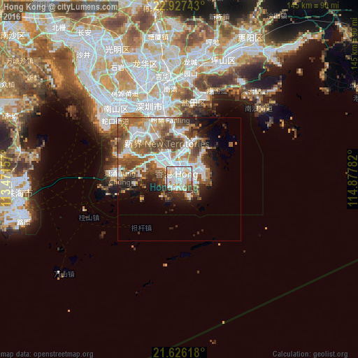
Analysis of Hong Kong night lights 2016
Square area 10x10 km:
 37.69%
90-99
32.2%80-89
4.92%70-79
7.95%60-69
7.01%50-59
3.6%40-49
4.73%30-39
1.14%20-29
0.76%10-19
0%0-9
0%Square area 50x50 km:
8.63%90-99
7.05%80-89
1.82%70-79
3.87%60-69
4.05%50-59
6.14%40-49
5.85%30-39
3.61%20-29
4.1%10-19
5.77%0-9
49.11%Clear (daylight) street map image can be seen on geolist.org.
Map coordinates:
22° 55' 38.7" North, 113° 28' 17.7" East
22° 16' 42" North, 114° 10' 28.9" East
21° 37' 34.2" North, 114° 52' 40.2" East
Some cities around Hong Kong sort by population:
• Kowloon
4.4 km =2.7 mi,  11°
11°
• Tsuen Wan
12.1 km =7.5 mi,  328°
328°
• Sha Tin
11.7 km =7.3 mi,  4°
4°
• Yung Shue Wan
8.6 km =5.3 mi,  227°
227°
• Wong Tai Sin
8 km =5 mi, 6°
• Sham Shui Po
6 km =3.7 mi,  344°
344°
• Central
1.7 km =1.1 mi,  287°
287°
• Wan Chai
0.4 km =0.2 mi, 327°
1819729 (p: 7,012,738)
Sources (retrieved 2019-11-25):
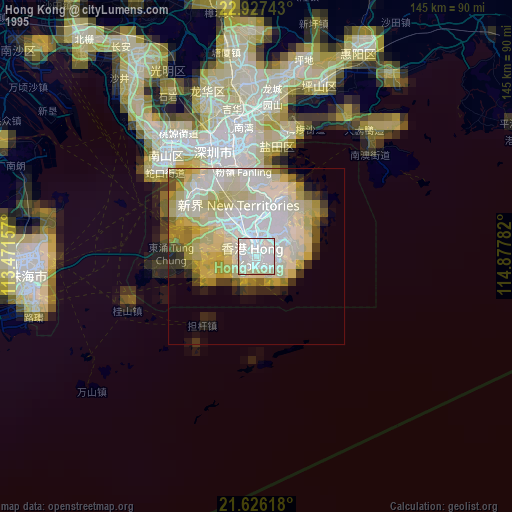
» NASA, Earths city lights 1995
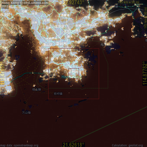
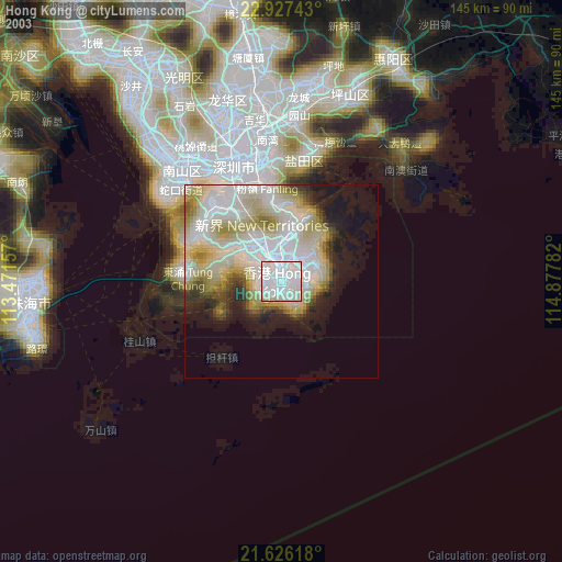
» NASA city lights 2003
» Earth at Night: Flat Maps 2012, 2016