Puerto Barrios night lights from space
Night Light of Puerto Barrios (Izabal) from space (Guatemala) Src. Average luminocity for 10x10km area is 32.3853% and for 50x50km: 2.1431%.
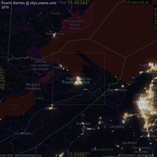
Analysis of Puerto Barrios night lights 2016
Square area 10x10 km:
 3.9%
3.9%90-99
5.84%80-89
2.6%70-79
6.49%60-69
6.71%50-59
4.98%40-49
3.25%30-39
1.95%20-29
5.41%10-19
27.71%0-9
31.17%Square area 50x50 km:
0.18%90-99
0.26%80-89
0.28%70-79
0.4%60-69
0.37%50-59
0.26%40-49
0.25%30-39
0.22%20-29
0.28%10-19
1.84%0-9
95.67%Clear (daylight) street map image can be seen on geolist.org.
Map coordinates:
16° 24' 12.4" North, 89° 17' 51.3" West
15° 43' 40" North, 88° 35' 40" West
15° 2' 59.5" North, 87° 53' 28.8" West
Some cities around Puerto Barrios sort by population:
• San Pedro Sula, HN
65.9 km =40.9 mi,  112°
112°
• Choloma, HN
69.8 km =43.4 mi,  100°
100°
• Cofradía, HN
60 km =37.3 mi,  127°
127°
• Morales
38.8 km =24.1 mi,  222°
222°
• Lívingston
20.1 km =12.5 mi,  303°
303°
• Azacualpa, HN
43 km =26.7 mi,  173°
173°
• Punta Gorda, BZ
47.2 km =29.3 mi,  330°
330°
• Cuyamel, HN
42.8 km =26.6 mi, 99°
3591062 (p: 56,605)
Sources (retrieved 2019-11-25):
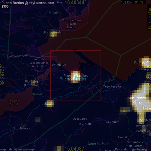
» NASA, Earths city lights 1995
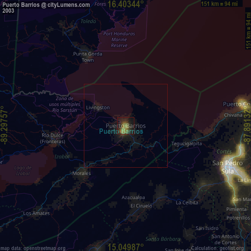
» NASA city lights 2003
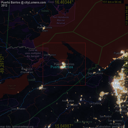
» Earth at Night: Flat Maps 2012, 2016