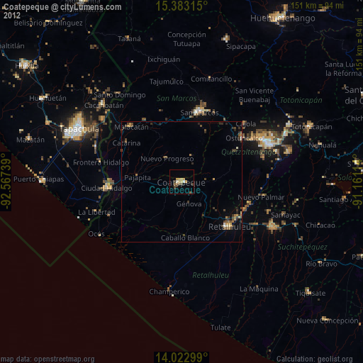
Coatepeque night lights from space
Night Light of Coatepeque (Quetzaltenango) from space (Guatemala) Src. Average luminocity for 10x10km area is 20.4463% and for 50x50km: 4.0763%.
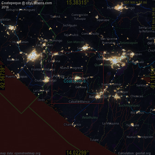
Analysis of Coatepeque night lights 2016
Square area 10x10 km:
 0%
0%90-99
3.93%80-89
2.69%70-79
4.55%60-69
1.65%50-59
1.03%40-49
4.34%30-39
5.37%20-29
5.37%10-19
8.06%0-9
63.02%Square area 50x50 km:
0.02%90-99
0.4%80-89
0.4%70-79
0.45%60-69
0.6%50-59
0.44%40-49
0.97%30-39
1.25%20-29
1.48%10-19
2.59%0-9
91.4%Clear (daylight) street map image can be seen on geolist.org.
Map coordinates:
15° 22' 59.3" North, 92° 34' 2.6" West
14° 42' 14.9" North, 91° 51' 51.3" West
14° 1' 22.8" North, 91° 9' 40.1" West
Some cities around Coatepeque sort by population:
• Nuevo San Carlos
22.1 km =13.7 mi,  123°
123°
• Colomba
14.3 km =8.9 mi,  88°
88°
• El Quetzal
8.8 km =5.5 mi,  34°
34°
• Flores Costa Cuca
8 km =5 mi,  179°
179°
• Pajapita
18.5 km =11.5 mi,  276°
276°
• Nuevo Progreso
11.4 km =7.1 mi,  328°
328°
• El Tumbador
19.3 km =12 mi,  337°
337°
• El Asintal
19 km =11.8 mi,  129°
129°
3598122 (p: 45,654)
Sources (retrieved 2019-11-25):
» Earth at Night: Flat Maps 2012, 2016