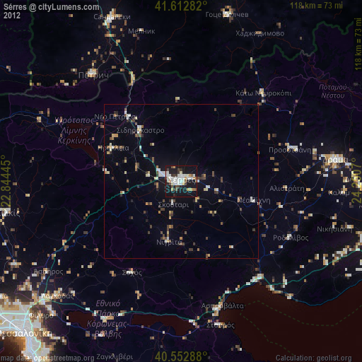
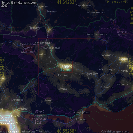
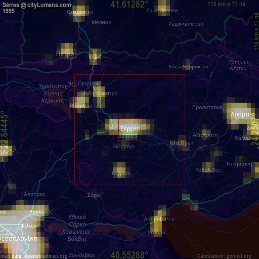
Sérres night lights from space
Night Light of Sérres (Central Macedonia) from space (Greece) Src. Average luminocity for 10x10km area is 38.2857% and for 50x50km: 5.4138%.
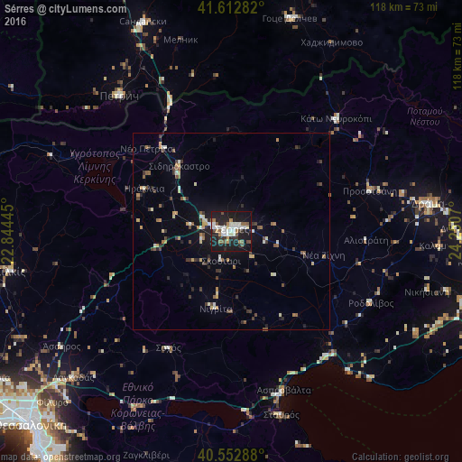
Analysis of Sérres night lights 2016
Square area 10x10 km:
 6.66%
6.66%90-99
10.23%80-89
1.95%70-79
2.11%60-69
3.9%50-59
6.01%40-49
3.57%30-39
3.9%20-29
12.99%10-19
44.64%0-9
4.06%Square area 50x50 km:
0.4%90-99
0.86%80-89
0.51%70-79
0.66%60-69
0.52%50-59
0.91%40-49
0.75%30-39
0.98%20-29
1.25%10-19
3.72%0-9
89.44%Clear (daylight) street map image can be seen on geolist.org.
Map coordinates:
41° 36' 46.2" North, 22° 50' 40" East
41° 5' 6" North, 23° 32' 51.3" East
40° 33' 10.4" North, 24° 15' 2.5" East
Some cities around Sérres sort by population:
• Dráma
50.8 km =31.6 mi,  81°
81°
• Petrich, BG
45 km =28 mi,  320°
320°
• Sandanski, BG
57.9 km =36 mi,  337°
337°
• Kilkís
57.4 km =35.7 mi,  259°
259°
• Gotse Delchev, BG
55.8 km =34.7 mi,  16°
16°
• Oraiókastro
66 km =41 mi,  233°
233°
• Lagkadás
55 km =34.2 mi, 227°
• Sidirókastro
21.3 km =13.2 mi, 321°
734330 (p: 58,287)
Sources (retrieved 2019-11-25):
» NASA, Earths city lights 1995
» NASA city lights 2003
» Earth at Night: Flat Maps 2012, 2016