Pérama night lights from space
Night Light of Pérama (Attica) from space (Greece) Src. Average luminocity for 10x10km area is 69% and for 50x50km: 37.2001%.
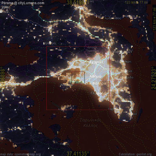
Analysis of Pérama night lights 2016
Square area 10x10 km:
 12.66%
90-99
15.58%80-89
9.58%70-79
11.85%60-69
14.45%50-59
6.49%40-49
15.58%30-39
10.06%20-29
3.73%10-19
0%0-9
0%Square area 50x50 km:
12.3%90-99
8.12%80-89
3.31%70-79
4.08%60-69
4.62%50-59
3.15%40-49
3.75%30-39
4.24%20-29
6.07%10-19
8.64%0-9
41.71%Clear (daylight) street map image can be seen on geolist.org.
Map coordinates:
38° 31' 11.9" North, 22° 52' 8.3" East
37° 58' 3.9" North, 23° 34' 19.6" East
37° 24' 40.9" North, 24° 16' 30.8" East
Some cities around Pérama sort by population:
• Piraeus
7.1 km =4.4 mi,  113°
113°
• Níkaia
6.8 km =4.2 mi,  91°
91°
• Keratsíni
4.2 km =2.6 mi,  97°
97°
• Korydallós
6.8 km =4.2 mi,  74°
74°
• Agía Varvára
8.1 km =5 mi, 72°
• Salamína
6.6 km =4.1 mi,  266°
266°
• Agios Ioannis Rentis
8.2 km =5.1 mi, 92°
• Drapetsóna
4.9 km =3 mi, 113°
255588 (p: 25,389)
Sources (retrieved 2019-11-25):
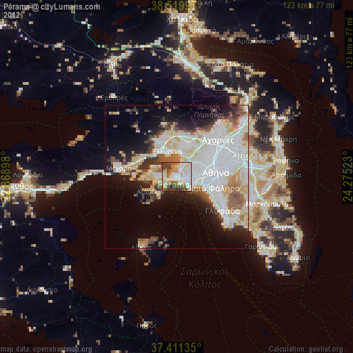
» Earth at Night: Flat Maps 2012, 2016