Korydallós night lights from space
Night Light of Korydallós (Attica) from space (Greece) Src. Average luminocity for 10x10km area is 95.5308% and for 50x50km: 44.4128%.

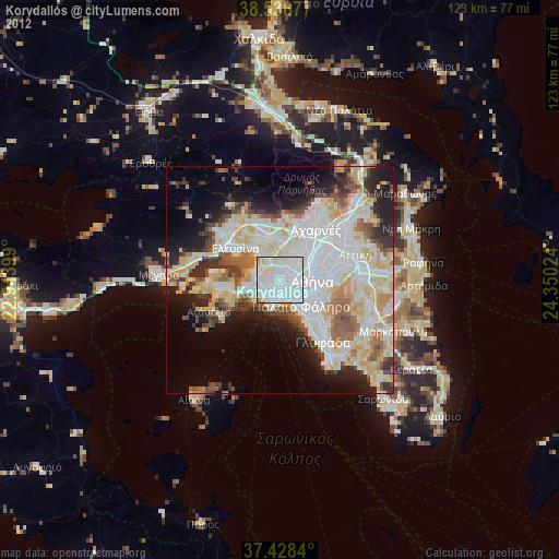
Analysis of Korydallós night lights 2016
Square area 10x10 km:
 51.46%
90-99
31.98%80-89
6.33%70-79
8.28%60-69
1.95%50-59
0%40-49
0%30-39
0%20-29
0%10-19
0%0-9
0%Square area 50x50 km:
13.15%90-99
9.96%80-89
4.58%70-79
5.81%60-69
6.01%50-59
3.84%40-49
4.52%30-39
5.09%20-29
8.15%10-19
8.34%0-9
30.56%Clear (daylight) street map image can be seen on geolist.org.
Map coordinates:
38° 32' 12.4" North, 22° 56' 38.4" East
37° 59' 4.8" North, 23° 38' 49.6" East
37° 25' 42.2" North, 24° 21' 0.9" East
Some cities around Korydallós sort by population:
• Níkaia
2 km =1.2 mi,  172°
172°
• Keratsíni
3.4 km =2.1 mi,  224°
224°
• Aigáleo
3.2 km =2 mi,  92°
92°
• Chaïdári
3.4 km =2.1 mi,  29°
29°
• Agía Varvára
1.3 km =0.8 mi,  65°
65°
• Agios Ioannis Rentis
2.7 km =1.7 mi,  144°
144°
• Távros
4.1 km =2.5 mi,  112°
112°
• Drapetsóna
4.4 km =2.7 mi,  208°
208°
8310183 (p: 63,445)
Sources (retrieved 2019-11-25):
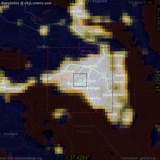
» NASA, Earths city lights 1995
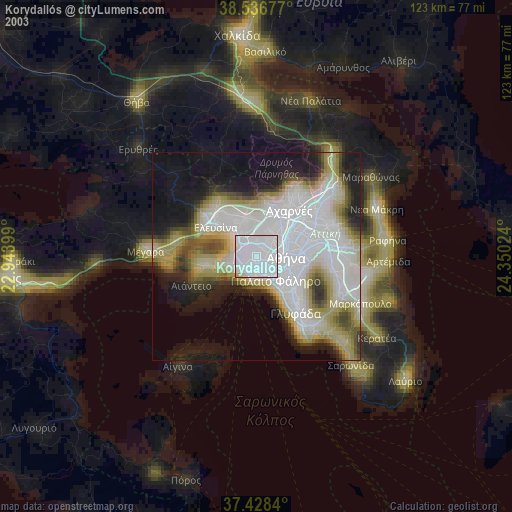
» NASA city lights 2003
» Earth at Night: Flat Maps 2012, 2016