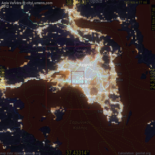
Agía Varvára night lights from space
Night Light of Agía Varvára (Attica) from space (Greece) Src. Average luminocity for 10x10km area is 96.4481% and for 50x50km: 45.275%.
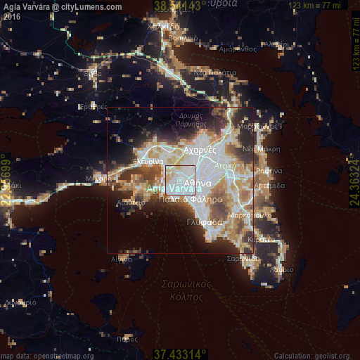
Analysis of Agía Varvára night lights 2016
Square area 10x10 km:
 58.93%
90-99
27.27%80-89
5.84%70-79
7.63%60-69
0.32%50-59
0%40-49
0%30-39
0%20-29
0%10-19
0%0-9
0%Square area 50x50 km:
13.26%90-99
10.12%80-89
4.72%70-79
5.86%60-69
6.13%50-59
4.16%40-49
4.62%30-39
5.23%20-29
8.57%10-19
8.38%0-9
28.93%Clear (daylight) street map image can be seen on geolist.org.
Map coordinates:
38° 32' 29.1" North, 22° 57' 25.2" East
37° 59' 21.8" North, 23° 39' 36.4" East
37° 25' 59.3" North, 24° 21' 47.7" East
Some cities around Agía Varvára sort by population:
• Peristéri
4 km =2.5 mi,  43°
43°
• Níkaia
2.7 km =1.7 mi,  199°
199°
• Keratsíni
4.6 km =2.9 mi,  229°
229°
• Aigáleo
2.1 km =1.3 mi,  108°
108°
• Korydallós
1.3 km =0.8 mi,  245°
245°
• Chaïdári
2.5 km =1.6 mi,  11°
11°
• Agios Ioannis Rentis
2.8 km =1.7 mi,  170°
170°
• Távros
3.4 km =2.1 mi,  128°
128°
264111 (p: 26,550)
Sources (retrieved 2019-11-25):
» Earth at Night: Flat Maps 2012, 2016