Lárisa night lights from space
Night Light of Lárisa (Thessaly) from space (Greece) Src. Average luminocity for 10x10km area is 58.1429% and for 50x50km: 9.2351%.
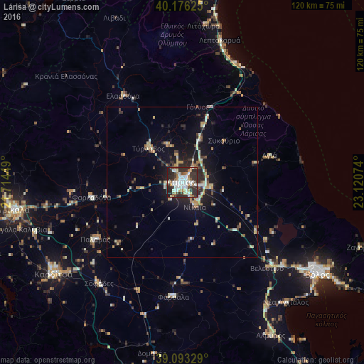
Analysis of Lárisa night lights 2016
Square area 10x10 km:
 13.31%
90-99
16.4%80-89
4.38%70-79
6.17%60-69
6.01%50-59
4.71%40-49
4.87%30-39
15.75%20-29
24.35%10-19
4.06%0-9
0%Square area 50x50 km:
0.78%90-99
1.82%80-89
1.16%70-79
1.04%60-69
1.18%50-59
0.8%40-49
1.03%30-39
1.67%20-29
2.88%10-19
6.08%0-9
81.54%Clear (daylight) street map image can be seen on geolist.org.
Map coordinates:
40° 10' 34.5" North, 21° 42' 52.2" East
39° 38' 12.8" North, 22° 25' 3.4" East
39° 5' 35.8" North, 23° 7' 14.7" East
Some cities around Lárisa sort by population:
• Kardítsa
52.2 km =32.4 mi,  234°
234°
• Týrnavos
15.7 km =9.8 mi,  315°
315°
• Fársala
38.2 km =23.7 mi,  184°
184°
• Giánnouli
3.8 km =2.4 mi,  331°
331°
• Elassóna
34.7 km =21.6 mi, 325°
• Litóchoro
52 km =32.3 mi,  7°
7°
• Ampelóna
12.8 km =8 mi,  339°
339°
• Palamás
34.3 km =21.3 mi,  236°
236°
258576 (p: 144,651)
Sources (retrieved 2019-11-25):
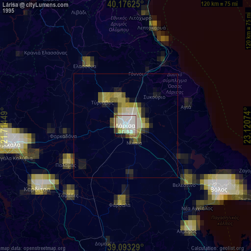
» NASA, Earths city lights 1995
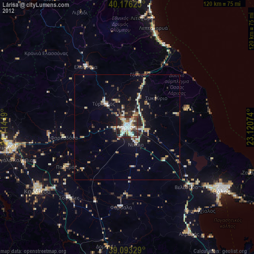
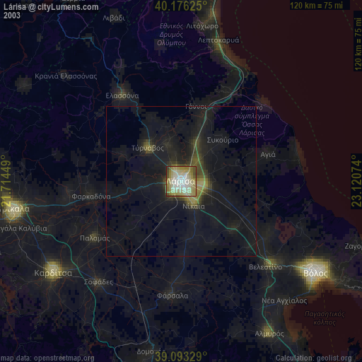
» NASA city lights 2003
» Earth at Night: Flat Maps 2012, 2016