Litóchoro night lights from space
Night Light of Litóchoro (Central Macedonia) from space (Greece) Src. Average luminocity for 10x10km area is 13.7013% and for 50x50km: 5.3281%.
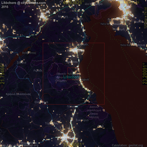
Analysis of Litóchoro night lights 2016
Square area 10x10 km:
 0.32%
0.32%90-99
0.81%80-89
2.11%70-79
1.3%60-69
3.57%50-59
1.46%40-49
4.55%30-39
2.6%20-29
0.16%10-19
13.96%0-9
69.16%Square area 50x50 km:
0.48%90-99
0.82%80-89
0.5%70-79
0.5%60-69
0.8%50-59
0.59%40-49
0.77%30-39
1.17%20-29
1.25%10-19
4.63%0-9
88.51%Clear (daylight) street map image can be seen on geolist.org.
Map coordinates:
40° 38' 10.5" North, 21° 47' 40.8" East
40° 6' 2" North, 22° 29' 52" East
39° 33' 38.2" North, 23° 12' 3.3" East
Some cities around Litóchoro sort by population:
• Lárisa
52 km =32.3 mi,  187°
187°
• Kateríni
18.8 km =11.7 mi,  2°
2°
• Týrnavos
44.1 km =27.4 mi,  203°
203°
• Epanomí
51.4 km =31.9 mi,  45°
45°
• Néa Michanióna
50.8 km =31.6 mi,  37°
37°
• Giánnouli
49 km =30.4 mi, 190°
• Elassóna
34.9 km =21.7 mi,  229°
229°
• Ampelóna
41.1 km =25.5 mi, 195°
735399 (p: 6,709)
Sources (retrieved 2019-11-25):
» Earth at Night: Flat Maps 2012, 2016