Ampelóna night lights from space
Night Light of Ampelóna (Thessaly) from space (Greece) Src. Average luminocity for 10x10km area is 13.8393% and for 50x50km: 8.9388%.
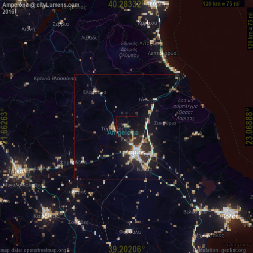
Analysis of Ampelóna night lights 2016
Square area 10x10 km:
 0%
0%90-99
1.3%80-89
1.95%70-79
2.11%60-69
1.79%50-59
0.97%40-49
1.3%30-39
2.44%20-29
2.27%10-19
18.51%0-9
67.37%Square area 50x50 km:
0.8%90-99
1.76%80-89
0.95%70-79
1.07%60-69
1.12%50-59
0.75%40-49
0.89%30-39
1.91%20-29
2.92%10-19
5.94%0-9
81.89%Clear (daylight) street map image can be seen on geolist.org.
Map coordinates:
40° 16' 60" North, 21° 39' 45.5" East
39° 44' 41.3" North, 22° 21' 56.7" East
39° 12' 7.4" North, 23° 4' 8" East
Some cities around Ampelóna sort by population:
• Lárisa
12.8 km =8 mi,  159°
159°
• Tríkala
55.3 km =34.4 mi,  247°
247°
• Týrnavos
6.6 km =4.1 mi,  263°
263°
• Fársala
50.1 km =31.1 mi,  178°
178°
• Giánnouli
9 km =5.6 mi, 163°
• Elassóna
22.5 km =14 mi,  317°
317°
• Litóchoro
41.1 km =25.5 mi,  15°
15°
• Palamás
39.3 km =24.4 mi,  218°
218°
265206 (p: 5,961)
Sources (retrieved 2019-11-25):
» Earth at Night: Flat Maps 2012, 2016