Távros night lights from space
Night Light of Távros (Attica) from space (Greece) Src. Average luminocity for 10x10km area is 97.7321% and for 50x50km: 47.5396%.
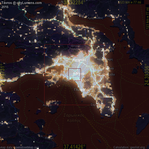
Analysis of Távros night lights 2016
Square area 10x10 km:
 71.1%
71.1%90-99
22.4%80-89
2.11%70-79
1.3%60-69
1.3%50-59
1.79%40-49
0%30-39
0%20-29
0%10-19
0%0-9
0%Square area 50x50 km:
13.37%90-99
10.84%80-89
4.92%70-79
6.33%60-69
6.7%50-59
4.64%40-49
4.98%30-39
5.7%20-29
9.16%10-19
7.9%0-9
25.46%Clear (daylight) street map image can be seen on geolist.org.
Map coordinates:
38° 31' 22.2" North, 22° 59' 14.3" East
37° 58' 14.3" North, 23° 41' 25.5" East
37° 24' 51.3" North, 24° 23' 36.8" East
Some cities around Távros sort by population:
• Athens
3.6 km =2.2 mi,  66°
66°
• Kallithéa
2.4 km =1.5 mi,  159°
159°
• Níkaia
3.6 km =2.2 mi,  262°
262°
• Néa Smýrni
3.5 km =2.2 mi,  143°
143°
• Aigáleo
1.5 km =0.9 mi,  336°
336°
• Agía Varvára
3.4 km =2.1 mi,  308°
308°
• Moskháton
2.7 km =1.7 mi,  201°
201°
• Agios Ioannis Rentis
2.3 km =1.4 mi,  253°
253°
253025 (p: 14,972)
Sources (retrieved 2019-11-25):
» Earth at Night: Flat Maps 2012, 2016