Kalampáka night lights from space
Night Light of Kalampáka (Thessaly) from space (Greece) Src. Average luminocity for 10x10km area is 8.3377% and for 50x50km: 4.6257%.
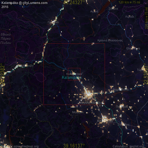
Analysis of Kalampáka night lights 2016
Square area 10x10 km:
 0%
0%90-99
0.65%80-89
1.79%70-79
1.46%60-69
0.16%50-59
3.57%40-49
2.11%30-39
0.81%20-29
0.65%10-19
1.14%0-9
87.66%Square area 50x50 km:
0.19%90-99
0.62%80-89
0.56%70-79
0.54%60-69
0.91%50-59
0.73%40-49
0.65%30-39
0.73%20-29
1.46%10-19
3.62%0-9
89.99%Clear (daylight) street map image can be seen on geolist.org.
Map coordinates:
40° 14' 35.8" North, 20° 55' 25.8" East
39° 42' 16" North, 21° 37' 37" East
39° 9' 40.9" North, 22° 19' 48.3" East
Some cities around Kalampáka sort by population:
• Tríkala
20.6 km =12.8 mi,  143°
143°
• Kardítsa
45.4 km =28.2 mi,  146°
146°
• Týrnavos
56.8 km =35.3 mi,  86°
86°
• Grevená
45.6 km =28.3 mi,  338°
338°
• Elassóna
52.4 km =32.6 mi,  66°
66°
• Ampelóna
63.3 km =39.3 mi, 85°
• Palamás
47.2 km =29.3 mi,  124°
124°
• Siátista
62.4 km =38.8 mi,  353°
353°
261601 (p: 8,138)
Sources (retrieved 2019-11-25):
» Earth at Night: Flat Maps 2012, 2016