Ioánnina night lights from space
Night Light of Ioánnina (Epirus) from space (Greece) Src. Average luminocity for 10x10km area is 51.9627% and for 50x50km: 6.445%.
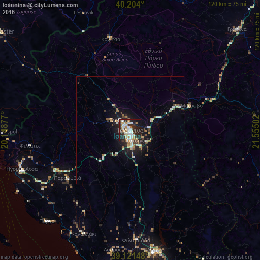
Analysis of Ioánnina night lights 2016
Square area 10x10 km:
 10.23%
90-99
16.07%80-89
4.06%70-79
6.33%60-69
7.95%50-59
0.81%40-49
3.41%30-39
5.52%20-29
27.6%10-19
15.1%0-9
2.92%Square area 50x50 km:
0.6%90-99
1.52%80-89
0.63%70-79
0.72%60-69
0.84%50-59
0.38%40-49
0.71%30-39
0.9%20-29
2.25%10-19
4.45%0-9
87.01%Clear (daylight) street map image can be seen on geolist.org.
Map coordinates:
40° 12' 14.4" North, 20° 8' 55.6" East
39° 39' 53.5" North, 20° 51' 6.8" East
39° 7' 17.3" North, 21° 33' 18.1" East
Some cities around Ioánnina sort by population:
• Gjirokastër, AL
76.1 km =47.3 mi,  306°
306°
• Árta
57.3 km =35.6 mi,  168°
168°
• Sarandë, AL
76.1 km =47.3 mi,  287°
287°
• Përmet, AL
76.3 km =47.4 mi,  326°
326°
• Grevená
67.7 km =42.1 mi,  46°
46°
• Anatolí
3.5 km =2.2 mi,  160°
160°
• Igoumenítsa
53.2 km =33.1 mi,  250°
250°
• Kalampáka
66.5 km =41.3 mi,  86°
86°
261779 (p: 65,574)
Sources (retrieved 2019-11-25):
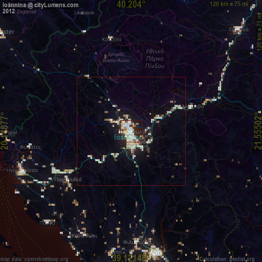
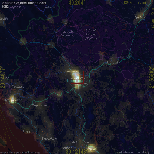
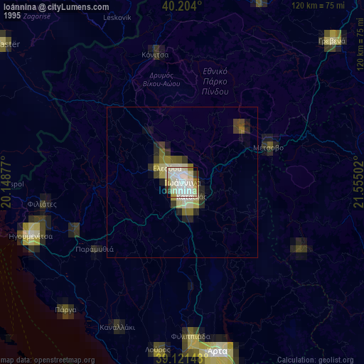
» NASA, Earths city lights 1995
» NASA city lights 2003
» Earth at Night: Flat Maps 2012, 2016