Corfu night lights from space
Night Light of Corfu (Ionian Islands) from space (Greece) Src. Average luminocity for 10x10km area is 25.9432% and for 50x50km: 3.2229%.
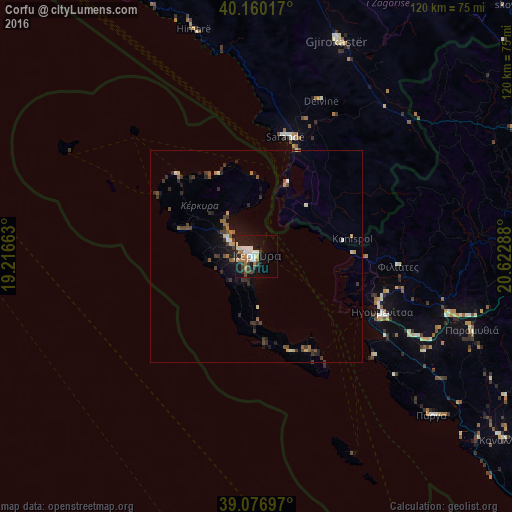
Analysis of Corfu night lights 2016
Square area 10x10 km:
 4.55%
4.55%90-99
5.84%80-89
1.62%70-79
0.81%60-69
6.98%50-59
0.32%40-49
2.44%30-39
5.19%20-29
2.44%10-19
28.9%0-9
40.91%Square area 50x50 km:
0.21%90-99
0.48%80-89
0.18%70-79
0.24%60-69
0.69%50-59
0.32%40-49
0.58%30-39
1.05%20-29
0.69%10-19
2.41%0-9
93.15%Clear (daylight) street map image can be seen on geolist.org.
Map coordinates:
40° 9' 36.6" North, 19° 12' 59.9" East
39° 37' 27.9" North, 19° 55' 12.6" East
39° 4' 37.1" North, 20° 37' 22.4" East
Some cities around Corfu sort by population:
• Vlorë, AL
101 km =62.8 mi,  338°
338°
• Ioánnina
79.9 km =49.6 mi,  86°
86°
• Gjirokastër, AL
53.6 km =33.3 mi,  20°
20°
• Sarandë, AL
28.8 km =17.9 mi,  14°
14°
• Tepelenë, AL
75.1 km =46.7 mi, 6°
• Përmet, AL
77.1 km =47.9 mi,  28°
28°
• Anatolí
81 km =50.3 mi, 89°
• Igoumenítsa
32.7 km =20.3 mi,  114°
114°
2463679 (p: 27,003)
Sources (retrieved 2019-11-25):
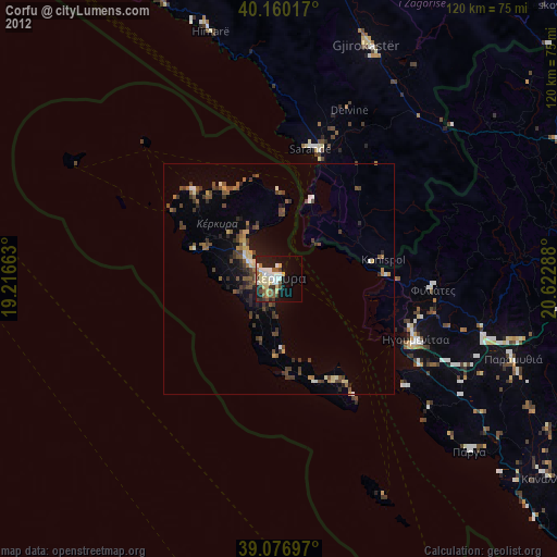
» Earth at Night: Flat Maps 2012, 2016