Tepelenë night lights from space
Night Light of Tepelenë (Gjirokastër) from space (Albania) Src. Average luminocity for 10x10km area is 1.2058% and for 50x50km: 0.5122%.
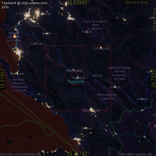
Analysis of Tepelenë night lights 2016
Square area 10x10 km:
 0%
0%90-99
0%80-89
0%70-79
0.68%60-69
0%50-59
0%40-49
0%30-39
1.19%20-29
0.85%10-19
0%0-9
97.28%Square area 50x50 km:
0.04%90-99
0.07%80-89
0.11%70-79
0.05%60-69
0.09%50-59
0.09%40-49
0.07%30-39
0.14%20-29
0.06%10-19
0.01%0-9
99.28%Clear (daylight) street map image can be seen on geolist.org.
Map coordinates:
40° 49' 47.9" North, 19° 18' 57.8" East
40° 17' 45" North, 20° 1' 9" East
39° 45' 26.7" North, 20° 43' 20.3" East
Some cities around Tepelenë sort by population:
• Berat
45.9 km =28.5 mi,  352°
352°
• Gjirokastër
26.5 km =16.5 mi,  157°
157°
• Sarandë
46.8 km =29.1 mi,  181°
181°
• Çorovodë
29.1 km =18.1 mi,  37°
37°
• Përmet
29 km =18 mi,  103°
103°
• Poliçan
35.8 km =22.2 mi,  10°
10°
• Ballsh
41.4 km =25.7 mi,  324°
324°
• Selenicë
41.6 km =25.8 mi,  308°
308°
781443 (p: 11,955)
Sources (retrieved 2019-11-25):
» Earth at Night: Flat Maps 2012, 2016